Discovery Ski Area
| Discovery Ski Area | |
|---|---|
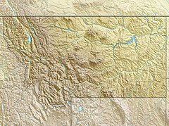
Location in Montana | |
| Location | Granite County, Montana |
| Nearest major city | Philipsburg, Montana |
| Coordinates | 46°15′23″N 113°14′31″W / 46.25639°N 113.24194°W |
| Top elevation | 8,158 feet (2,487 m) |
| Base elevation | 6,480 feet (1,980 m) |
| Skiable area | 2,200 acres (8.9 km2) |
| Trails | 67 |
| Longest run | 1.5 miles (2.4 km) |
| Lift system | 5 triples, 2 doubles, 1 surface |
| Snowfall | 215 " |
| Website | Official website |
Discovery Ski Area is an alpine ski area in the southwestern part of the state of Montana, United States. Situated on Rumsey and Jubilee mountains, the area consists of four different faces and provides for beginner groomed runs to expert bowl skiing. The area has seven lifts for Downhill, Telemark and cross-country skiing. The ski area is often open early in the season and is known to stay open late into the next year often extending lift operations through early April. Discovery is usually only open on weekends to begin the season, but days and hours will often expand through the winter season.
Location
[edit]Discovery is located in western part of the state of Montana near Georgetown Lake off Montana Highway 1. Discovery Ski Area is located in the Beaverhead–Deerlodge National Forest.


