
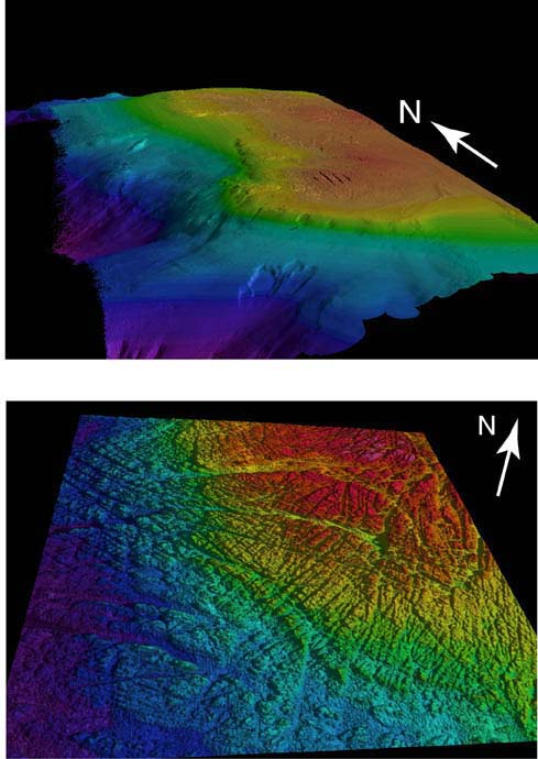
File:3-D Maps of Heceta Bank using multibeam sonar data. Top pane shows bathymetry for the entire bank. Bottom pane is a close-up view of the north crest.jpg
Size of this preview: 425 × 600 pixels. Other resolutions: 170 × 240 pixels | 489 × 690 pixels.
Original file (489 × 690 pixels, file size: 69 KB, MIME type: image/jpeg)
| This is a file from the Wikimedia Commons. Information from its description page there is shown below. Commons is a freely licensed media file repository. You can help. |
Summary
| Description |
English: Image courtesy of Lewis and Clark Legacy 2001 |
| Date | |
| Source | https://oceanexplorer.noaa.gov/explorations/lewis_clark01/background/seafloormapping/media/heceta_orientations.html |
| Author | Lewis & Clark 2001, NOAA/OER. |
Licensing
This image is in the public domain because it contains materials that originally came from the U.S. National Oceanic and Atmospheric Administration, taken or made as part of an employee's official duties.
|

|
This media file is uncategorized.
Please help improve this media file by adding it to one or more categories, so it may be associated with related media files (how?), and so that it can be more easily found.
Please notify the uploader with {{subst:Please link images|File:3-D Maps of Heceta Bank using multibeam sonar data. Top pane shows bathymetry for the entire bank. Bottom pane is a close-up view of the north crest.jpg}} ~~~~ |
File history
Click on a date/time to view the file as it appeared at that time.
| Date/Time | Thumbnail | Dimensions | User | Comment | |
|---|---|---|---|---|---|
| current | 18:24, 27 November 2018 | | 489 × 690 (69 KB) | Dvkone7 | User created page with UploadWizard |
File usage
The following pages on the English Wikipedia use this file (pages on other projects are not listed):
Global file usage
The following other wikis use this file: