
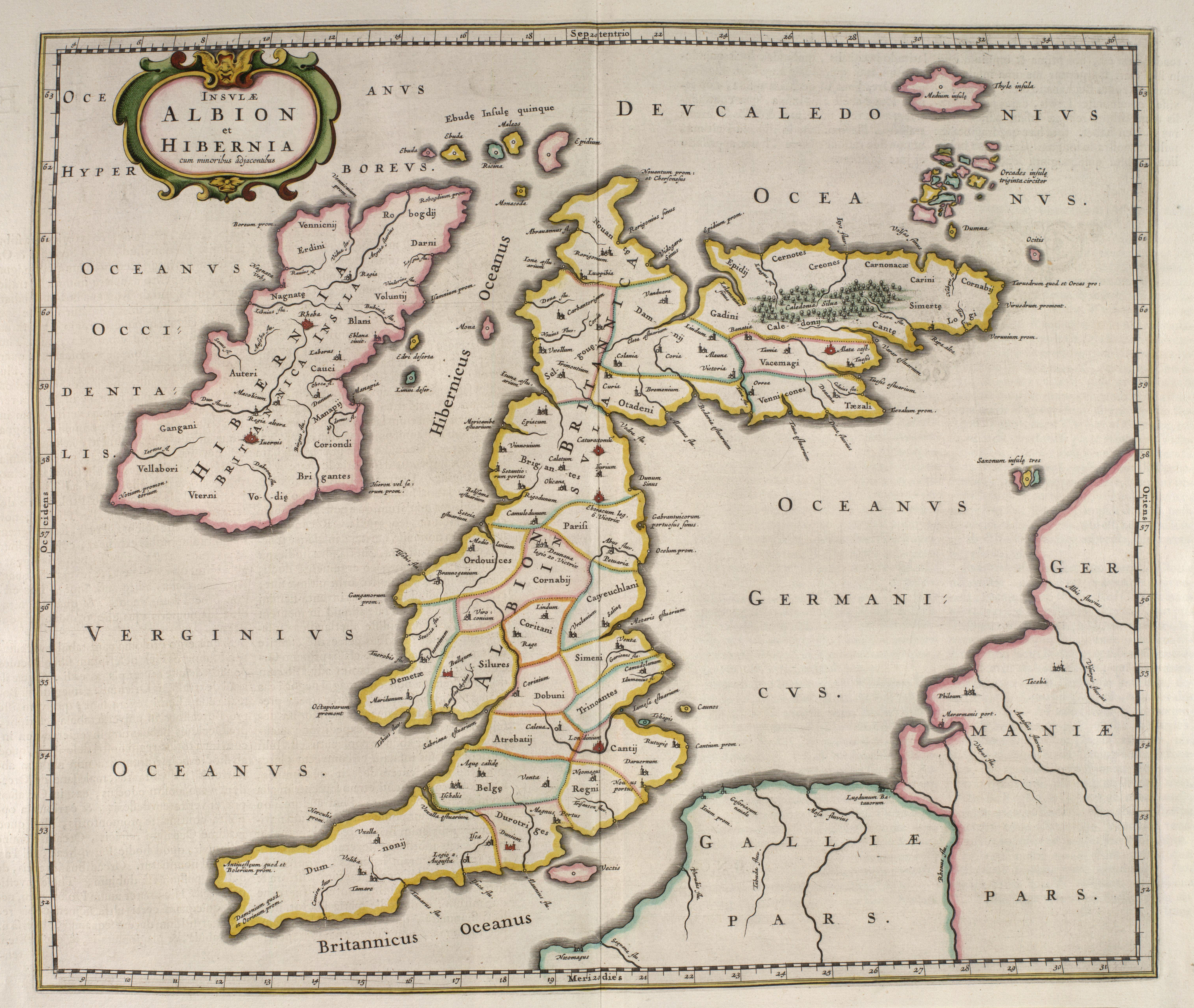
File:Blaeu - Atlas of Scotland 1654 - INSULÆ ALBION et HIBERNIA cum minoribus adjacentibus - British Isles.jpg
Size of this preview: 710 × 599 pixels. Other resolutions: 284 × 240 pixels | 569 × 480 pixels | 910 × 768 pixels | 1,213 × 1,024 pixels | 2,427 × 2,048 pixels | 6,083 × 5,134 pixels.
Original file (6,083 × 5,134 pixels, file size: 6.91 MB, MIME type: image/jpeg)
| This is a file from the Wikimedia Commons. Information from its description page there is shown below. Commons is a freely licensed media file repository. You can help. |
| Description | Ptolemy's 1st European Map: INSULAE ALBION ET HIBERNIA - Old Great Britain | |||
| Date | ||||
| Source |
|
|||
| Author | Blaeu | |||
| Permission (Reusing this file) |
Public domain (70 years post mortem auctoris) |


|
This work is in the public domain in its country of origin and other countries and areas where the copyright term is the author's life plus 100 years or fewer. | |
| This file has been identified as being free of known restrictions under copyright law, including all related and neighboring rights. | |
File history
Click on a date/time to view the file as it appeared at that time.
| Date/Time | Thumbnail | Dimensions | User | Comment | |
|---|---|---|---|---|---|
| current | 13:47, 17 June 2007 | | 6,083 × 5,134 (6.91 MB) | Simplicius | {{Information |Description=INSULAE ALBION ET HIBERNIA - Old Great Britain |Source=[http://www.nls.uk/maps/early/blaeu/blaeu_maps_index.html National Library of Scotland] |Date=1654 |Author=Blaeu |Permission=Public domain (70 years post mortem auctoris |
File usage
The following pages on the English Wikipedia use this file (pages on other projects are not listed):
Global file usage
The following other wikis use this file:
- Usage on de.wikipedia.org
- Usage on es.wikipedia.org
- Usage on fr.wikipedia.org
- Usage on it.wikipedia.org
- Usage on ja.wikibooks.org
- Usage on pl.wikipedia.org
- Usage on pt.wikipedia.org
- Usage on sl.wikipedia.org
- Usage on baike.710302.xyz