
File:Central and Eastern Europe at the time of Augustus 6 AD.jpg

Size of this preview: 800 × 584 pixels. Other resolutions: 320 × 234 pixels | 640 × 467 pixels | 1,024 × 748 pixels | 1,280 × 935 pixels | 2,600 × 1,899 pixels.
Original file (2,600 × 1,899 pixels, file size: 740 KB, MIME type: image/jpeg)
| This is a file from the Wikimedia Commons. Information from its description page there is shown below. Commons is a freely licensed media file repository. You can help. |
Summary
| Description | |
| Date | |
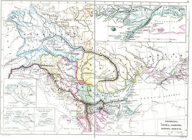
| Source | Strabonis Geographicorum tabulae XV 1877, pp: 1088-1089 by Strabo, Karl Wilhelm Ludwig Müller, editor Ambrosio Firmin-Didot. |
| Author | Karl Wilhelm Ludwig Müller (Carolus Mullerus) (1813–1894) |
Licensing
|
This work is in the public domain in its country of origin and other countries and areas where the copyright term is the author's life plus 100 years or fewer. | |
| This file has been identified as being free of known restrictions under copyright law, including all related and neighboring rights. | |
File history
Click on a date/time to view the file as it appeared at that time.
| Date/Time | Thumbnail | Dimensions | User | Comment | |
|---|---|---|---|---|---|
| current | 05:11, 26 April 2011 | | 2,600 × 1,899 (740 KB) | Boldwin | {{Information |Description ={{en|1=Map of Getica (Daci Terra Getarum) Germania, Sarmatia, Illyria, Thracia according to Strabo (ca.18 AD). The map is from the book "Strabonis Geographicorum tabulae XV" by Strabo of the author = German scholar Karl |
File usage
The following 2 pages use this file:
Global file usage
The following other wikis use this file:
- Usage on el.wikipedia.org
- Usage on it.wikipedia.org
- Usage on pt.wikipedia.org
- Usage on ro.wikipedia.org
- Usage on ru.wikipedia.org
- Usage on sr.wikipedia.org
- Usage on uz.wikipedia.org