Jump to content

File:Colombia Mapa Oficial.svg

Page contents not supported in other languages.
This is a file from the Wikimedia Commons
From Wikipedia, the free encyclopedia

Original file (SVG file, nominally 2,072 × 2,339 pixels, file size: 3.58 MB)

Featured picture

Wikimedia CommonsWikipedia

This is a featured picture on Wikimedia Commons (Featured pictures) and is considered one of the finest images. See its nomination here.

 This is a featured picture on the Spanish language Wikipedia (Recursos destacados) and is considered one of the finest images. See its nomination here.

If you have an image of similar quality that can be published under a suitable copyright license, be sure to upload it, tag it, and nominate it.

Summary

Description
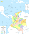
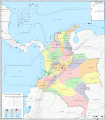
English (en): Political map and boundaries of the Republic of Colombia.

Map of Colombia, denoting its limits and its administrative division.

For this map were taken into account the layout and names of major rivers, international boundaries with their respective benchmarks and border coordinates, geographical features, and major islands in both oceans. It also has the names and dates of all the border treaties signed by Colombia with its neighbors.

español (es): Mapa político y de fronteras de la República de Colombia.

Mapa de Colombia, denotando sus límites y su división administrativa.

Para el presente mapa se han tenido en cuenta el trazado y nombre de los ríos principales, las fronteras internacionales con sus respectivos hitos y coordenadas fronterizas, accidentes geográficos, e islas importantes en ambos océanos. Posee además los nombres y fechas de todos los tratados fronterizos suscritos por Colombia con sus países vecinos.

français (fr): Carte politique et frontières de la République de Colombie.

Carte de la Colombie, montrant ses limites et ses divisions administratives.

Sur cette catre, on peut voir le tracé et le nom des principaux cours d'eau, les frontières internationales, avec les coordonnées de leurs points remarquables, les structures géographiques, et les iles principales dans les deux océans. Sont aussi notés les noms et les dates des principaux traités internationaux signés par la Colombie et ses voisins.

Date
Source

Own work

español (es): Procedencia de la información:
  • Trazado de los bordes del mapa basado en la información de Demis (ver licencia aquí).
  • Trazado de fronteras obtenido de:
Tratado de límites entre Colombia y Brasil (texto en español).
Tratado de límites entre Colombia y Ecuador (texto en español).
Tratado de límites entre Colombia y Panamá (texto en español).
Tratado de límites entre Colombia y Perú (texto en español).
Tratados de límites entre Colombia y Venezuela (texto en español).
Tratado de límites marinos en el Caribe entre Colombia y Costa Rica (texto en español)(texto en inglés)(mapa)
Tratado de límites marinos en el Pacífico entre Colombia y Costa Rica (texto en español)
Tratado de límites marinos entre Colombia y Ecuador (texto en español)(texto en inglés)(mapa).
Tratado de límites marinos entre Colombia y Haití (texto en español).
Tratado de límites marinos entre Colombia y Honduras (texto en español).
Tratado de límites marinos entre Colombia y Jamaica (texto en español).
Tratado de límites marinos entre Colombia y República Dominicana (texto en español).
Tratado de límites marinos entre Colombia y Panamá (texto en español)(texto en inglés)(mapa 1)(mapa 2).
Tratado sobre cuestiones territoriales entre Colombia y Nicaragua (texto en español).
English (en): Origins of information:
Creator
Permission
(Reusing this file)
Trabajo propio, reconocimiento requerido, mantener licencia: (Creative Commons CC-BY-SA-3.0). Citar a Wikipedia ó a Wikimedia como fuente si la imagen es utilizada en otros medios que no sean de los proyectos de la familia Wikipedia.
Georeferencing Georeference the map in Wikimaps Warper If inappropriate please set warp_status = skip to hide.
Other versions


Licensing

I, the copyright holder of this work, hereby publish it under the following license:
w:en:Creative Commons
attribution share alike
This file is licensed under the Creative Commons Attribution-Share Alike 3.0 Unported license.
You are free:
  • to share – to copy, distribute and transmit the work
  • to remix – to adapt the work
Under the following conditions:
  • attribution – You must give appropriate credit, provide a link to the license, and indicate if changes were made. You may do so in any reasonable manner, but not in any way that suggests the licensor endorses you or your use.
  • share alike – If you remix, transform, or build upon the material, you must distribute your contributions under the same or compatible license as the original.

Captions

Add a one-line explanation of what this file represents

Items portrayed in this file

depicts

11 December 2009

image/svg+xml

d59c9e5116ce4ac144cdf7bbbf4778059f6d2416

3,751,038 byte

2,339 pixel

2,072 pixel

File history

Click on a date/time to view the file as it appeared at that time.

Date/TimeThumbnailDimensionsUserComment
current23:44, 5 April 2021Thumbnail for version as of 23:44, 5 April 20212,072 × 2,339 (3.58 MB)Milenioscuro+actualizo nuevos municipios +relieve
01:58, 28 January 2014Thumbnail for version as of 01:58, 28 January 20142,072 × 2,339 (3.32 MB)Milenioscuroes: cambio completo de estilo: mejores colores, mejoras en las fronteras internas y externas, inclusión de elementos como ferrocarriles y carreteras, ríos y lagos transparentes, etc. - ahora traducible - en: complete change of style: best colors, im...
07:09, 25 May 2012Thumbnail for version as of 07:09, 25 May 20122,083 × 2,350 (9.13 MB)Milenioscuromejoras, correcciones y otros
06:10, 10 March 2012Thumbnail for version as of 06:10, 10 March 20122,083 × 2,350 (9.64 MB)Milenioscurorecorto areas sobrantes, corrijo fronteras, carretaras y demas
03:27, 6 September 2010Thumbnail for version as of 03:27, 6 September 20102,268 × 2,676 (10.31 MB)Milenioscurocambio de escudo nacional (changed national coat of arms)
07:31, 29 December 2009Thumbnail for version as of 07:31, 29 December 20092,268 × 2,676 (10.5 MB)Milenioscuropequeños cambios
08:18, 19 December 2009Thumbnail for version as of 08:18, 19 December 20092,268 × 2,676 (10.49 MB)Milenioscurocorregidos algunos pequeños errores + explicación de la toponimia
02:42, 13 December 2009Thumbnail for version as of 02:42, 13 December 20092,268 × 2,676 (10.03 MB)Milenioscurocoordenadas laterales
07:23, 11 December 2009Thumbnail for version as of 07:23, 11 December 20092,268 × 2,676 (9.89 MB)Milenioscurocorrecciones
07:09, 11 December 2009Thumbnail for version as of 07:09, 11 December 20092,268 × 2,676 (9.74 MB)Milenioscuro{{Information |Description={{en|1=Map based on the [http://ssiglims.igac.gov.co/ssigl/mapas_de_colombia/galeria/IGAC/Oficial_F2004.pdf official map of the Republic of Colombia] from [http://mapascolombia.igac.gov.co/wps/portal/mapasdecolombia/ Instituto G

The following 2 pages use this file:

Global file usage

The following other wikis use this file:

Metadata