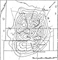
File:Damon Mound contour map.jpg
Appearance

Size of this preview: 586 × 600 pixels. Other resolutions: 234 × 240 pixels | 469 × 480 pixels | 843 × 863 pixels.
Original file (843 × 863 pixels, file size: 154 KB, MIME type: image/jpeg)
File history
Click on a date/time to view the file as it appeared at that time.
| Date/Time | Thumbnail | Dimensions | User | Comment | |
|---|---|---|---|---|---|
| current | 15:22, 12 August 2020 |  | 843 × 863 (154 KB) | Pi3.124 | Uploaded a work by N.M. Fenneman from OIL FIELDS OF THE TEXAS-LOUISIANA GULF COASTAL PLAIN, USGS Bulletin 282, https://pubs.usgs.gov/bul/0282/report.pdf with UploadWizard |
File usage
The following page uses this file:

