
File:EF3 damage Mullica Hills, New Jersey 2021.jpg
Size of this preview: 800 × 600 pixels. Other resolutions: 320 × 240 pixels | 640 × 480 pixels | 1,024 × 768 pixels | 1,280 × 960 pixels | 2,560 × 1,920 pixels | 4,032 × 3,024 pixels.
Original file (4,032 × 3,024 pixels, file size: 2.3 MB, MIME type: image/jpeg)
| This is a file from the Wikimedia Commons. Information from its description page there is shown below. Commons is a freely licensed media file repository. You can help. |
Summary
| Description |
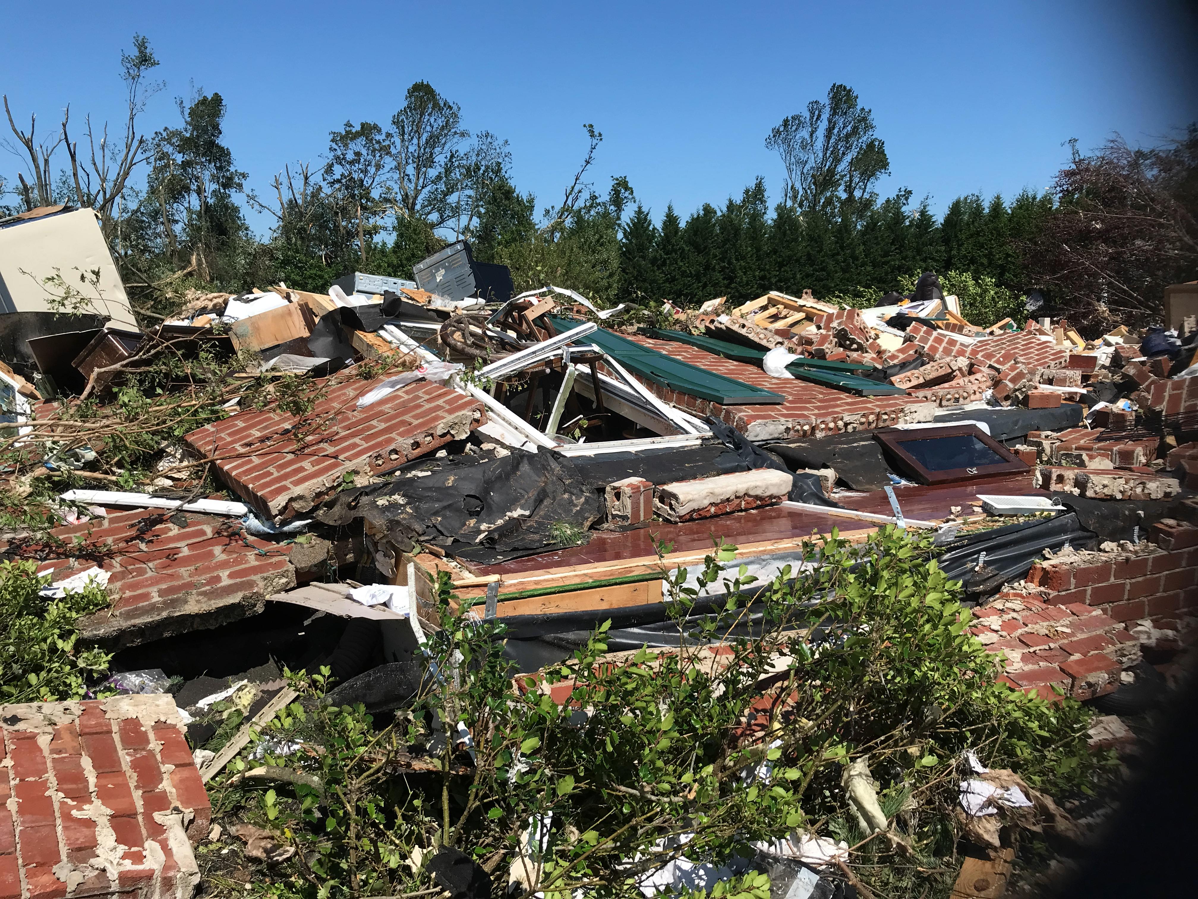
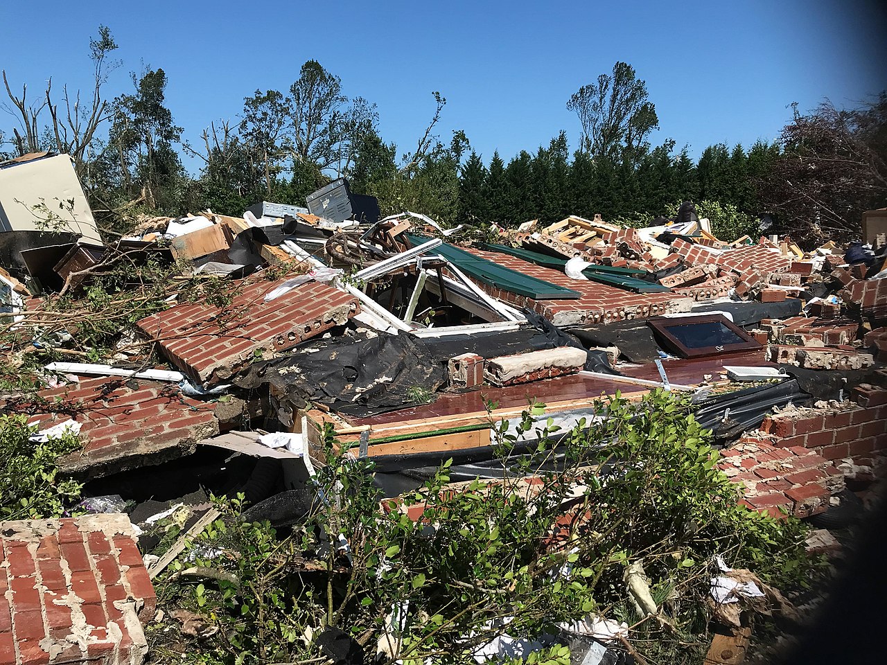
English: A home that was leveled by the EF3 Mullica Hills, New Jersey tornado produced by the remnants of Hurricane Ida. |
| Date | |
| Source | https://services.dat.noaa.gov/arcgis/rest/services/nws_damageassessmenttoolkit/DamageViewer/FeatureServer/0/2470225/attachments/1519212 |
| Author | NWS Mount Holly |
| Camera location | | View this and other nearby images on: OpenStreetMap |
|---|
Licensing
This file is in the public domain in the United States because it was solely created by employees of the National Weather Service or National Severe Storms Laboratory using the Damage Assessment Toolkit (DAT), an interactive map and database.
|
File history
Click on a date/time to view the file as it appeared at that time.
| Date/Time | Thumbnail | Dimensions | User | Comment | |
|---|---|---|---|---|---|
| current | 11:36, 3 January 2022 | | 4,032 × 3,024 (2.3 MB) | ChessEric | Uploaded a work by NWS Mount Holly from https://services.dat.noaa.gov/arcgis/rest/services/nws_damageassessmenttoolkit/DamageViewer/FeatureServer/0/2470225/attachments/1519212 with UploadWizard |
File usage
The following 3 pages use this file: