
File:Indochina map 1886.jpg

Size of this preview: 461 × 599 pixels. Other resolutions: 184 × 240 pixels | 369 × 480 pixels | 591 × 768 pixels | 788 × 1,024 pixels | 1,626 × 2,114 pixels.
Original file (1,626 × 2,114 pixels, file size: 533 KB, MIME type: image/jpeg)
| This is a file from the Wikimedia Commons. Information from its description page there is shown below. Commons is a freely licensed media file repository. You can help. |
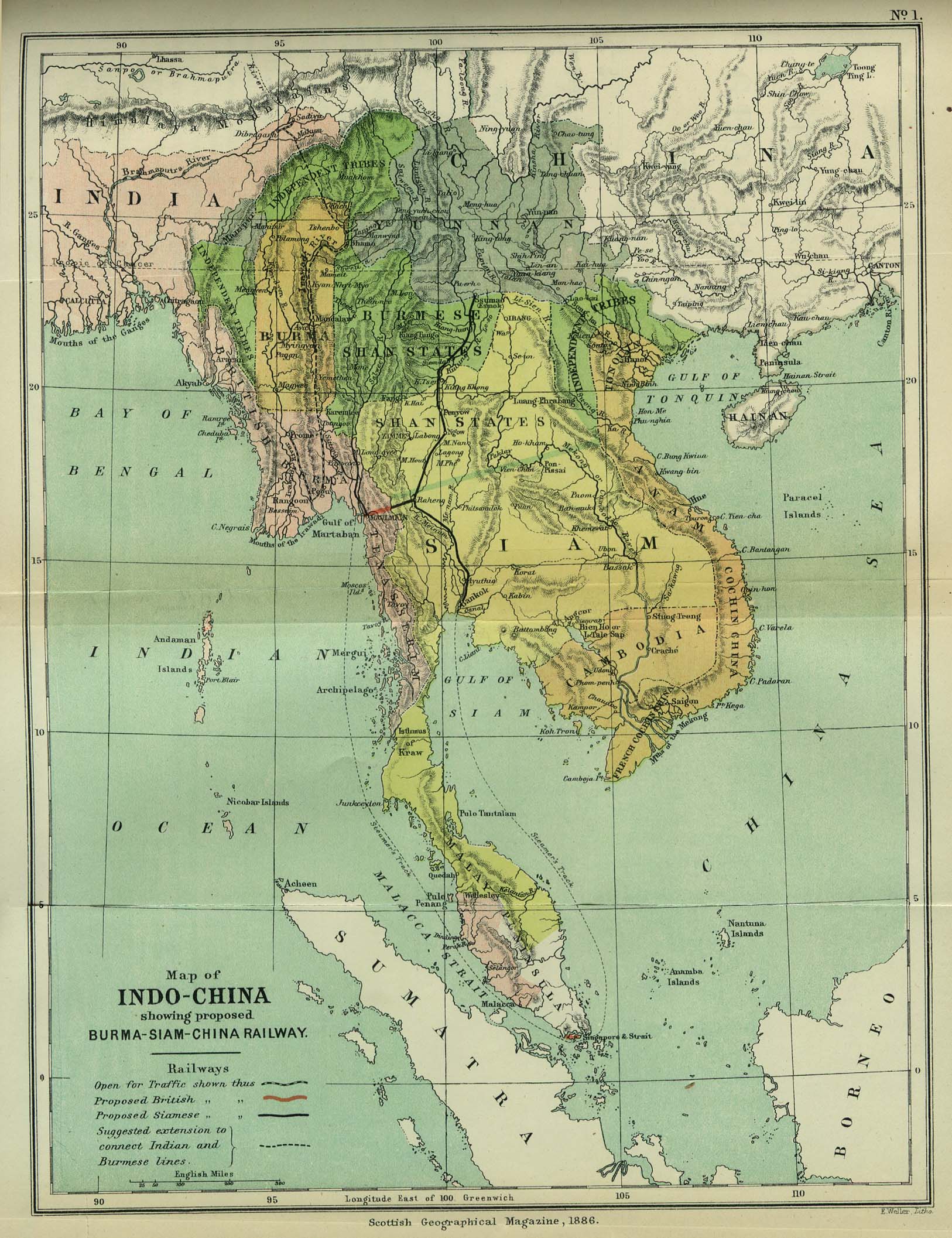
| Description | Map of Indochina | ||||
| Date | |||||
| Source | http://www.lib.utexas.edu/maps/cambodia.html (http://www.lib.utexas.edu/maps/historical/indo_china_1886.jpg); Scottish Geographical Magazine (Volume II) | ||||
| Author | Scottish Geographical Magazine and edited by Hugh A. Webster and Arthur Silva White | ||||
| Permission (Reusing this file) |
|
||||
| Other versions | File:IndoChina1886.jpg | ||||
File history
Click on a date/time to view the file as it appeared at that time.
| Date/Time | Thumbnail | Dimensions | User | Comment | |
|---|---|---|---|---|---|
| current | 02:56, 2 May 2008 | | 1,626 × 2,114 (533 KB) | Calliopejen1 | {{Information |Description=Map of French Indochina |Source=http://www.lib.utexas.edu/maps/cambodia.html (http://www.lib.utexas.edu/maps/historical/indo_china_1886.jpg) |Date=1886 |Author=Scottish Geographical Magazine |Permission={{PD-old}} |other_version |
File usage
The following page uses this file:
Global file usage
The following other wikis use this file:
- Usage on bcl.wikipedia.org
- Usage on el.wikipedia.org
- Usage on en.wikiversity.org
- Usage on fi.wikipedia.org
- Usage on got.wikipedia.org
- Usage on kn.wikipedia.org
- Usage on ms.wikipedia.org
- Usage on pa.wikipedia.org
- Usage on sl.wikipedia.org
- Usage on uz.wikipedia.org