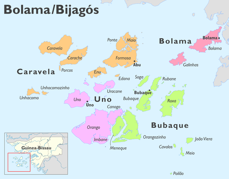
File:Map of the sectors of the Bolama Region, Guinea-Bissau.png
Appearance

Size of this preview: 768 × 599 pixels. Other resolutions: 308 × 240 pixels | 615 × 480 pixels | 984 × 768 pixels | 1,206 × 941 pixels.
Original file (1,206 × 941 pixels, file size: 172 KB, MIME type: image/png)
File history
Click on a date/time to view the file as it appeared at that time.
| Date/Time | Thumbnail | Dimensions | User | Comment | |
|---|---|---|---|---|---|
| current | 05:16, 24 March 2010 |  | 1,206 × 941 (172 KB) | Chumwa | Polão → Poilão |
| 14:35, 21 March 2010 |  | 1,609 × 1,255 (242 KB) | Chumwa | == {{int:filedesc}} == {{Information |Description= {{de|Karte der Sektoren der Region Bolama (Guinea-Bissau)}} {{en|Map of the sectors of the Bolama Region, Guinea-Bissau}} |Author=Maximilian Dörrbecker (Chumwa) |S |
File usage
The following 4 pages use this file:
Global file usage
The following other wikis use this file:
- Usage on de.wikipedia.org
- Usage on es.wikipedia.org
- Usage on fa.wikipedia.org
- Usage on fi.wikipedia.org
- Usage on hr.wikipedia.org
- Usage on hu.wikipedia.org
- Usage on it.wikipedia.org
- Usage on it.wikivoyage.org
- Usage on lt.wikipedia.org
- Usage on mdf.wikipedia.org
- Usage on pl.wikipedia.org
- Usage on pl.wiktionary.org
- Usage on pt.wikipedia.org
View more global usage of this file.
