
File:National delimitation in Middle Asia.jpg
Size of this preview: 800 × 538 pixels. Other resolutions: 320 × 215 pixels | 640 × 430 pixels | 1,024 × 688 pixels | 1,451 × 975 pixels.
Original file (1,451 × 975 pixels, file size: 568 KB, MIME type: image/jpeg)
| This is a file from the Wikimedia Commons. Information from its description page there is shown below. Commons is a freely licensed media file repository. You can help. |
Summary
| Description |
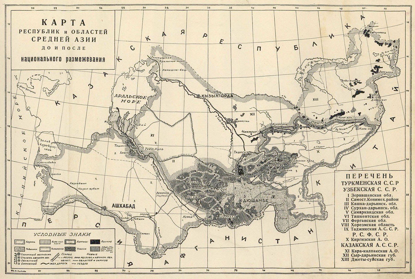
Русский: Карта республик и областей Средней Азии до и после национального размежевания из книги
Рамзин, К. Революция в Средней Азии. М.: Издательство Саку, 1928. [12] с., 125 л. ил.; 270х350 мм. 5000 экз. |
||||
| Date | |||||
| Source | Рамзин, К. Революция в Средней Азии. М.: Издательство Саку, 1928. | ||||
| Author | K. Ramzin | ||||
| Permission (Reusing this file) |
|
||||
File history
Click on a date/time to view the file as it appeared at that time.
| Date/Time | Thumbnail | Dimensions | User | Comment | |
|---|---|---|---|---|---|
| current | 17:28, 11 February 2018 | | 1,451 × 975 (568 KB) | Skrod | {{Information |Description ={{ru|1=Карта республик и областей Средней Азии до и после национального размежевания из книги Рамзин, К. Революция в Средне... |
File usage
The following pages on the English Wikipedia use this file (pages on other projects are not listed):
Global file usage
The following other wikis use this file:
- Usage on ba.wikipedia.org
- Usage on cv.wikipedia.org
- Usage on es.wikipedia.org
- Usage on fa.wikipedia.org
- Usage on it.wikipedia.org
- Usage on kk.wikipedia.org
- Usage on ko.wikipedia.org
- Usage on pt.wikipedia.org
- Usage on ru.wikipedia.org
- Usage on tr.wikipedia.org
- Usage on uz.wikipedia.org