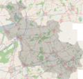
File:OSM - provincie Overijssel.PNG
Appearance

Size of this preview: 632 × 600 pixels. Other resolutions: 253 × 240 pixels | 506 × 480 pixels | 809 × 768 pixels | 1,079 × 1,024 pixels | 2,232 × 2,118 pixels.
Original file (2,232 × 2,118 pixels, file size: 5.48 MB, MIME type: image/png)
File history
Click on a date/time to view the file as it appeared at that time.
| Date/Time | Thumbnail | Dimensions | User | Comment | |
|---|---|---|---|---|---|
| current | 07:41, 26 October 2007 |  | 2,232 × 2,118 (5.48 MB) | Michiel1972 | |
| 17:59, 17 October 2007 |  | 2,232 × 2,118 (5.48 MB) | Michiel1972 | == Summary == {{Information |Description= "Overijssel" , |Source=*Map based on the free editable OSM map http://www.openstreetmap.org/index.html. Content is available under Creative Commons Attribution-ShareAlike 2.0 license. *Note: In september 2007, th |
File usage
No pages on the English Wikipedia use this file (pages on other projects are not listed).
Global file usage
The following other wikis use this file:
- Usage on de.wikipedia.org
- Usage on el.wikipedia.org
- Usage on frr.wikipedia.org
- Usage on baike.710302.xyz
