
File:Portage Valley Area.jpg
No higher resolution available.
Portage_Valley_Area.jpg (417 × 561 pixels, file size: 103 KB, MIME type: image/jpeg)
| This is a file from the Wikimedia Commons. Information from its description page there is shown below. Commons is a freely licensed media file repository. You can help. |
Summary
| Description |
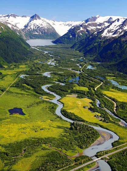
English: A view of the Portage Valley. Portage Creek travels through the center of the image, and the Portage Glacier Highway travels along the bottom part. |
| Date | Unknown date, probably 2011 |
| Source | http://www.fs.fed.us/wildflowers/regions/alaska/TrailOfBlueIce/index.shtml |
| Author | US Forest Service |
Licensing
This image is a work of the Forest Service of the United States Department of Agriculture. As a work of the U.S. federal government, the image is in the public domain.
|
File history
Click on a date/time to view the file as it appeared at that time.
| Date/Time | Thumbnail | Dimensions | User | Comment | |
|---|---|---|---|---|---|
| current | 00:52, 1 April 2013 | | 417 × 561 (103 KB) | A Texas Historian | Larger version, slightly cropped |
| 01:05, 9 October 2012 |  | 200 × 276 (22 KB) | A Texas Historian | User created page with UploadWizard |
File usage
The following pages on the English Wikipedia use this file (pages on other projects are not listed):
Global file usage
The following other wikis use this file:
- Usage on ceb.wikipedia.org
- Usage on de.wikipedia.org
- Usage on es.wikipedia.org
- Usage on it.wikipedia.org
- Usage on www.wikidata.org