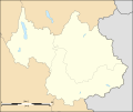
File:Savoie department location map.svg
Appearance

Size of this PNG preview of this SVG file: 714 × 600 pixels. Other resolutions: 286 × 240 pixels | 572 × 480 pixels | 915 × 768 pixels | 1,220 × 1,024 pixels | 2,439 × 2,048 pixels | 1,104 × 927 pixels.
Original file (SVG file, nominally 1,104 × 927 pixels, file size: 164 KB)
File history
Click on a date/time to view the file as it appeared at that time.
| Date/Time | Thumbnail | Dimensions | User | Comment | |
|---|---|---|---|---|---|
| current | 01:07, 4 September 2008 |  | 1,104 × 927 (164 KB) | Sting | Color of the lakes |
| 00:19, 5 August 2008 |  | 1,104 × 927 (164 KB) | Sting | More precise boundaries | |
| 18:53, 30 July 2008 |  | 1,104 × 927 (124 KB) | Sting | + rivers ; int. boundary passing on top of Mont Blanc | |
| 18:06, 25 July 2008 |  | 1,104 × 927 (74 KB) | Sting | - border | |
| 23:40, 19 July 2008 |  | 1,104 × 927 (77 KB) | Sting | == Summary == {{Location|45|30|00|N|06|24|00|E|scale:1000000}} <br/> {{Information |Description={{en|Blank map of the department of Savoie, France, for geo-location purpose.<br/>Scale : 1:800,000 (precision : 200 m)}} {{fr|Carte vierge du d |
File usage
The following 15 pages use this file:
- Courchevel Altiport
- Lac d'Aiguebelette
- Lac de Lessy
- Lac de Tignes
- Lac des Évettes
- Lac du Bourget
- Le Chabichou
- Molard Noir
- Vanoise National Park
- Talk:Battle of Kursk/Archive 2
- Wikipedia:WikiProject Maps/Conventions/Location maps
- Wikipedia:WikiProject Maps/Conventions/Location maps (series N)
- Wikipedia talk:WikiProject Maps/Archive 2009
- Module:Location map/data/France Savoie
- Module:Location map/data/France Savoie/doc
Global file usage
The following other wikis use this file:
- Usage on als.wikipedia.org
- Usage on ar.wikipedia.org
- Usage on ban.wikipedia.org
- Usage on bs.wikipedia.org
- Usage on ceb.wikipedia.org
- Usage on cs.wikipedia.org
- Usage on da.wikipedia.org
- Usage on de.wikipedia.org
- Usage on el.wikipedia.org
- Usage on eo.wikipedia.org
- Montmélian
- Peisey-Nancroix
- La Chapelle (Savoie)
- Frontenex
- Ŝablono:Situo sur mapo Francio Savoie
- Bourg-Saint-Maurice
- Saint-Jean-de-Maurienne
- La Motte-Servolex
- Modane
- Tignes
- Valloire
- Bourg-Saint-Maurice (stacidomo)
- Aiguebelette-le-Lac
- Aillon-le-Jeune
- Aillon-le-Vieux
- Aime-la-Plagne
- Aiton (Savoie)
- Albiez-le-Jeune
- Albiez-Montrond
- Allondaz
- Les Allues
- Apremont (Savoie)
- Arbin
- Arith
- Attignat-Oncin
- Les Avanchers-Valmorel
- Avressieux
- Avrieux
- Ayn (Savoie)
- La Balme
- Barberaz
- Barby (Savoie)
- Bassens (Savoie)
- La Bâthie
- La Bauche
- Beaufort (Savoie)
- Belmont-Tramonet
View more global usage of this file.


