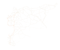
File:Syria location map road overlay.svg
Appearance

Size of this PNG preview of this SVG file: 725 × 599 pixels. Other resolutions: 290 × 240 pixels | 581 × 480 pixels | 929 × 768 pixels | 1,239 × 1,024 pixels | 2,478 × 2,048 pixels | 922 × 762 pixels.
Original file (SVG file, nominally 922 × 762 pixels, file size: 66 KB)
File history
Click on a date/time to view the file as it appeared at that time.
| Date/Time | Thumbnail | Dimensions | User | Comment | |
|---|---|---|---|---|---|
| current | 05:52, 2 March 2022 |  | 922 × 762 (66 KB) | Artoria2e5 | Remove masking rectangle preventing display of Aleppo roads, something yall tried to fix... wrongly. |
| 05:40, 2 March 2022 |  | 922 × 762 (66 KB) | Artoria2e5 | Sorry for reverting, but you made it a big image blob. That's completely against the point of an SVG! || Reverted to version as of 21:11, 18 February 2016 (UTC) | |
| 15:13, 17 February 2020 |  | 5,200 × 4,298 (1.57 MB) | TheMapLurker | Removed non-transparent box to the east of Aleppo city, and added more details to fill in the empty box around Aleppo city. | |
| 21:11, 18 February 2016 |  | 922 × 762 (66 KB) | Deuar | edits: Eastern Syria. That's the last of the bigger edits I hope. | |
| 18:27, 12 February 2016 |  | 922 × 762 (61 KB) | Deuar | Raqqa and part of desert area | |
| 02:30, 8 February 2016 |  | 922 × 762 (51 KB) | Deuar | fixing run of southern Syria roads | |
| 21:47, 30 January 2016 |  | 922 × 762 (46 KB) | Deuar | minor fixes in desert, and of excessive transparency | |
| 17:31, 30 January 2016 |  | 922 × 762 (46 KB) | Deuar | roads were too thin. hard to see. | |
| 17:12, 30 January 2016 |  | 922 × 762 (47 KB) | Deuar | Fixing accuracy of roads around Qalamoun and in the region Aleppo->Raqqa. Indicated minor desert roads with dashed lines. (Choosing minor according to what Google maps has to say). There is actually much ambiguity in the desert with regard to roads. | |
| 14:33, 28 January 2016 |  | 922 × 762 (41 KB) | Deuar | This version saved as plain SVG rather than Inkscape SVG. Maybe will help smartphones? |
File usage
The following 16 pages use this file:
- Talk:Control of cities during the Syrian civil war/Archive 59
- User:André437
- User:Bigles
- User:BlookyNapsta/sandbox
- User:Edisonabcd/sandbox/Syrian, Iraqi, and Lebanese insurgencies detailed map
- User:GBRV/sandbox
- Template:Syrian, Iraqi, and Lebanese insurgencies detailed map
- Template:Syrian Civil War detailed map
- Template:Syrian Civil War detailed map/sandbox
- Template:Syrian Civil War overview map
- Template:Syrian and Iraqi insurgency detailed map
- Module:Syrian, Iraqi, and Lebanese insurgencies detailed map/doc
- Module:Syrian Civil War detailed map/doc
- Module:Syrian Civil War detailed map/sandbox/doc
- Module:Syrian Civil War overview map/doc
- Module:Syrian and Iraqi insurgency detailed map/doc
Global file usage
The following other wikis use this file:
- Usage on azb.wikipedia.org
- Usage on fa.wikipedia.org
- Usage on id.wikipedia.org
- Usage on ku.wikipedia.org
- Usage on ur.wikipedia.org
- Usage on baike.710302.xyz

