
File:Thailand provinces six regions.png
Size of this preview: 356 × 599 pixels. Other resolutions: 143 × 240 pixels | 285 × 480 pixels | 892 × 1,500 pixels.
Original file (892 × 1,500 pixels, file size: 153 KB, MIME type: image/png)
| This is a file from the Wikimedia Commons. Information from its description page there is shown below. Commons is a freely licensed media file repository. You can help. |
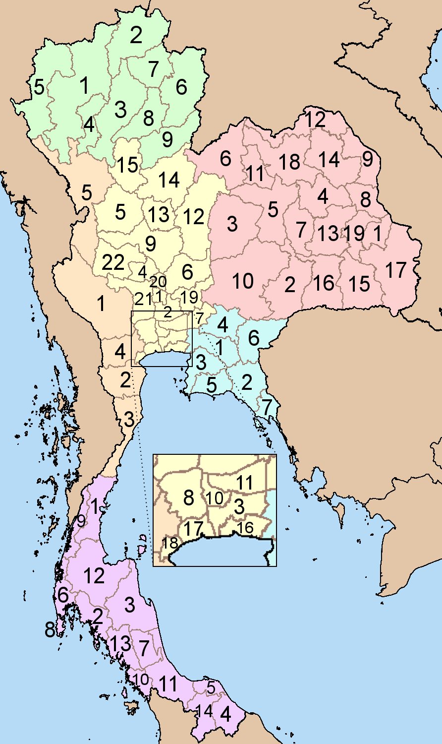
Map of Thailand showing the provinces numbered. Numbering is done according to alphabetic sorting of the standard english transscription of the province name, done for each of the six regions separately.
North
|
North-East
|
|
Central
|
East
South
|
| Description | Map of Thailand showing the provinces numbered. Numbering is done according to alphabetic sorting of the standard english transscription of the province name, done for each of the six regions separately. | ||||||||
| Date | Original image 2004-03-21; This version 2008-04-19 | ||||||||
| Source | Based on Image:BlankMap Thailand.png and Image:Thailand provinces.png | ||||||||
| Author | Ahoerstemeier, edits by Paul_012 | ||||||||
| Permission (Reusing this file) |
This file is licensed under the Creative Commons Attribution-Share Alike 1.0 Generic license.
|
||||||||
| Other versions |
Image:Thailand provinces.png, which divides the provinces into five regions |


File history
Click on a date/time to view the file as it appeared at that time.
| Date/Time | Thumbnail | Dimensions | User | Comment | |
|---|---|---|---|---|---|
| current | 11:43, 19 April 2008 | | 892 × 1,500 (153 KB) | Paul 012 | Corrected numbering |
| 19:03, 18 April 2008 |  | 268 × 450 (28 KB) | Paul 012 | {{Information |Description=Map of Thailand showing the provinces numbered. Numbering is done according to alphabetic sorting of the standard english transscription of the province name, done for each of the six regions separately. |Source=Based on [[:Imag |
File usage
The following 3 pages use this file:
Global file usage
The following other wikis use this file:
- Usage on ar.wikipedia.org
- Usage on bg.wikipedia.org
- Usage on bpy.wikipedia.org
- Usage on ckb.wikipedia.org
- Usage on de.wikipedia.org
- Usage on fa.wikipedia.org
- Usage on gl.wikipedia.org
- Usage on hy.wikipedia.org
- Usage on id.wikipedia.org
- Usage on it.wikipedia.org
- Usage on mzn.wikipedia.org
- Usage on new.wikipedia.org
- Usage on roa-tara.wikipedia.org
- Usage on sco.wikipedia.org
- Usage on sv.wikipedia.org
- Usage on sw.wikipedia.org
- Usage on uk.wikipedia.org
- Usage on vi.wikipedia.org
- Usage on war.wikipedia.org