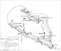
File:Wake Island map Dec 1941.PNG
Appearance

Size of this preview: 709 × 599 pixels. Other resolutions: 284 × 240 pixels | 568 × 480 pixels | 950 × 803 pixels.
Original file (950 × 803 pixels, file size: 306 KB, MIME type: image/png)
File history
Click on a date/time to view the file as it appeared at that time.
| Date/Time | Thumbnail | Dimensions | User | Comment | |
|---|---|---|---|---|---|
| current | 16:27, 3 March 2010 |  | 950 × 803 (306 KB) | Cobatfor | == {{int:filedesc}} == {{Information |Description=Map of Wake Island and its defenses in December 1941. |Source=U.S. National Park Service website ''A MAGNIFICENT FIGHT: Marines in the Battle for Wake Island'' [http://www.nps.gov/archive/wapa/indepth/extC |
File usage
The following page uses this file:
Global file usage
The following other wikis use this file:
- Usage on fr.wikipedia.org
- Usage on ja.wikipedia.org

