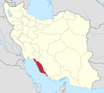
Jam, Iran
Appearance
Jam
Persian: جم | |
|---|---|
City | |
| Coordinates: 27°49′16″N 52°19′50″E / 27.82111°N 52.33056°E[1] | |
| Country | Iran |
| Province | Bushehr |
| County | Jam |
| District | Central |
| Population (2016)[2] | |
• Total | 31,436 |
| Time zone | UTC+3:30 (IRST) |
Jam (Persian: جم)[a] is a city in the Central District of Jam County, Bushehr province, Iran, serving as capital of both the county and the district.[4] It is also the administrative center for Jam Rural District.[5]
Demographics
[edit]Population
[edit]At the time of the 2006 National Census, the city's population was 10,809 in 2,734 households.[6] The 2011 census counted 16,313 people in 4,632 households.[7] The 2016 census measured the population of the city as 31,436 people in 9,356 households.[2]
Sports
[edit]Jam's main sport team is Pars Jonubi Jam football club who used to play in the Azadegan League and now in Persian Gulf Pro League, Iranian Premier League.[citation needed]
See also
[edit]Notes
[edit]References
[edit]- ^ OpenStreetMap contributors (27 August 2024). "Jam, Jam County" (Map). openstreetmap.org (OpenStreetMap) (in Persian). Retrieved 27 August 2024.
- ^ a b Census of the Islamic Republic of Iran, 1395 (2016): Bushehr Province. amar.org.ir (Report) (in Persian). The Statistical Center of Iran. Archived from the original (Excel) on 3 August 2017. Retrieved 19 December 2022.
- ^ Jam, Iran can be found at GEOnet Names Server, at this link, by opening the Advanced Search box, entering "-3067617" in the "Unique Feature Id" form, and clicking on "Search Database".
- ^ Aref, Mohammad Reza (c. 2024) [Approval 27 November 1381]. Approval of divisional reforms in Bushehr province. lamtakam.com (Report) (in Persian). Ministry of the Interior, Political-Defense Commission of the Government Council. Notification 56763-27853. Archived from the original on 26 April 2024. Retrieved 26 April 2024 – via Lam ta Kam.
- ^ Mousavi, Mirhossein (c. 2024) [Approved 18 August 1365]. Creation and formation of five rural districts including villages, farms and places in Kangan County under Bushehr province. lamtakam.com (Report) (in Persian). Ministry of the Interior, Council of Ministers. Proposal 7144.1.05.53. Archived from the original on 26 April 2024. Retrieved 26 April 2024 – via Lam ta Kam.
- ^ Census of the Islamic Republic of Iran, 1385 (2006): Bushehr Province. amar.org.ir (Report) (in Persian). The Statistical Center of Iran. Archived from the original (Excel) on 20 September 2011. Retrieved 25 September 2022.
- ^ Census of the Islamic Republic of Iran, 1390 (2011): Bushehr Province. irandataportal.syr.edu (Report) (in Persian). The Statistical Center of Iran. Archived from the original (Excel) on 3 April 2023. Retrieved 19 December 2022 – via Iran Data Portal, Syracuse University.


