Piedmont Avenue (Berkeley)
| Piedmont Avenue | |
|---|---|
 Piedmont Avenue, 1915 | |
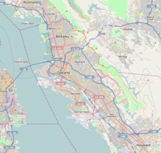
| Location | Piedmont Ave. between Gayley Rd. and Dwight Way |
| Coordinates | 37°52′04″N 122°15′07″W / 37.867789°N 122.251889°W |
| Built | 1865 |
| Architect | Frederick Law Olmsted |
| Official name | Piedmont Way[1] |
| Reference no. | 986[1] |
| Official name | Piedmont Way |
| Designated | February 22, 1990 |
| Reference no. | 130 |
Piedmont Avenue is a street in the city of Berkeley, California. Originally known as Piedmont Way, is the major street through the University of California, Berkeley's fraternity and sorority area. The street was originally named Piedmont Way.
Piedmont Way was conceived in 1865 by Frederick Law Olmsted, America's foremost landscape architect. As the centerpiece of a gracious residential community close beside the College of California, Olmsted envisioned a roadway that would follow the natural contours of the land and be sheltered from sun and wind by "an overarching bowery of foliage." This curvilinear, tree-lined parkway was Olmsted's first residential street design. It has served as the model for similar parkways across the US.
This original portion, now located between Gayley Road and Dwight Way, is designated as a Berkeley Landmark and California Historical Landmark.[1][2]
References
[edit]- ^ a b c "Piedmont Way". Office of Historic Preservation, California State Parks. Retrieved 2012-10-06.
- ^ "Berkeley Landmarks: Piedmont Way". berkeleyheritage.com. Retrieved 2021-03-05.
External links
[edit]- Berkeley Architectural Heritage Association
- Historic American Landscapes Survey (HALS) No. CA-2, "Piedmont Way & the Berkeley Property Tract, East of College Avenue between Dwight Way & U.C. Memorial Stadium, Berkeley, Alameda County, CA", 42 photos, 5 measured drawings, 13 data pages, 6 photo caption pages

