Groups of Traditional Buildings
Groups of Traditional Buildings (伝統的建造物群, Dentōteki Kenzōbutsu-gun) is a Japanese category of historic preservation introduced by a 1975 amendment of the law which mandates the protection of groups of traditional buildings which, together with their environment, form a beautiful scene. They can be post towns, castle towns, mining towns, merchant quarters, ports, farming or fishing villages, etc.[1] The Japanese government's Agency for Cultural Affairs recognizes and protects the country's cultural properties under the Law for the Protection of Cultural Properties.
Municipalities can designate items of particular importance as Preservation Districts for Groups of Traditional Buildings (伝統的建造物群保存地区, Dentōteki Kenzōbutsu-gun Hozon-chiku) and approve measures to protect them. Items of even higher importance are then designated Important Preservation Districts for Groups of Traditional Buildings (重要伝統的建造物群保存地区, Jūyō Dentōteki Kenzōbutsu-gun Hozon-chiku) by the central government.[1] The Agency for Cultural Affairs then provides guidance, advice, and funds for repairs and other work. Additional support is given in the form of preferential tax treatment.
As of May 23, 2024, 129 districts have been classified as Important Preservation Districts for Groups of Traditional Buildings.
List of Important Preservation Districts
[edit]Criteria
[edit]Important Preservation Districts for Groups of Traditional Buildings are designated according to three criteria:[2]
- Groups of traditional buildings that show excellent design as a whole
- Groups of traditional buildings and land distribution that preserve the old state of affairs well
- Groups of traditional buildings and their surrounding environment that show remarkable regional characteristics
Statistics
[edit]| Type | No. of Districts [note 1] |
|---|---|
| Brewers town | 4 |
| Casters town | 1 |
| Castle town | 4 |
| Dyeing and weaving town | 2 |
| Farming village | 5 |
| Fishing village | 2 |
| Hot-spring town | 1 |
| Jinaimachi[note 2] | 2 |
| Lacquerware town | 1 |
| Merchant quarter | 29 |
| Mining town | 2 |
| Mountain village | 15 |
| Porcelain-maker town | 1 |
| Port quarter | 13 |
| Post town | 11 |
| Salt works town | 1 |
| Sericulture community | 5 |
| Ship-owner quarter | 2 |
| Shrine quarter | 1 |
| Silk spinning town | 1 |
| Tea house quarter | 3 |
| Temple town | 8 |
| Textile town | 1 |
| Samurai quarter | 14 |
| Wax maker quarter | 1 |
| Zaigō town[note 3] | 13 |
Usage
[edit]The table's columns (except for Remarks and Images) are sortable by table headings. The following gives an overview of what is included in the table and how the sorting works.
- Name: name of the important preservation district as registered in the Database of National Cultural Properties[3]
- Type: type of the district (samurai / merchant / tea house /... quarter, post town, mountain village, mine town,...)
- Criterion: number of the criterion under which the district is designated (see list of criteria above)
- Area: area covered
- Remarks: general remarks
- Location: "town-name prefecture-name"; The column entries sort as "prefecture-name town-name".
- Images: picture of the structure
List
[edit]| Name | Type | Criterion | Area | Remarks | Location | Images |
|---|---|---|---|---|---|---|
| Motomachi and Suehiro-chō (函館市元町末広町, Hakodate-shi Motomachi Suehiro-chō)[4][5] | port quarter | 3 | 14.5 ha (36 acres) |
Old Hakodate port area, which was among the first ports to be opened during the bakumatsu period at the end of the Tokugawa Shogunate. Due to a fire in the Meiji period, the district consists of a mix of western, Japanese, and eclectic style town houses, religious and community buildings from the Meiji to the early Shōwa period. | Hakodate, Hokkaidō 41°45′56.7″N 140°42′45.02″E / 41.765750°N 140.7125056°E |

|
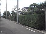
| Nakachō (弘前市仲町, Hirosaki-shi Nakamachi)[6] | samurai quarter | 2 | 10.6 ha (26 acres) |
Former samurai castle town of the Tsugaru Domain dating to the Keichō era (1596–1615) with principal houses, the front gate, sawara hedges and wooden fences. | Hirosaki, Aomori 40°36′46.43″N 140°28′1.07″E / 40.6128972°N 140.4669639°E |
|
| Nakamachi (黒石市中町, Kuroishi-shi Nakamachi)[7] | merchant quarter | 1 | 3.1 ha (7.7 acres) |
Merchant town and transportation center along the coastal road that prospered since the establishment of the Kuroishi Tsugaru family by Tsugaru Nobufusa in 1656. | Kuroishi, Aomori 40°38′41.43″N 140°35′47.65″E / 40.6448417°N 140.5965694°E |

|
| Jōnai Suwa-kōji (金ケ崎町城内諏訪小路, Kanegasaki-chō Jōnai Suwa-kōji)[8] | samurai quarter | 2 | 34.8 ha (86 acres) |
Samurai town at the order of the Date Domain established in strategic position on the Kitakami River with thatched houses and hedges. | Kanegasaki, Iwate 39°11′48.32″N 141°7′19.36″E / 39.1967556°N 141.1220444°E |
—
|
| Murata (村田町村田, Murata-machi Murata)[9] | merchant quarter | 1 | 7.4 ha (18 acres) |
Trading center in Sennan (仙南) dealing in safflower during the Edo and in cocoons starting from the Meiji period. | Murata, Miyagi 38°7′7.22″N 140°43′30.67″E / 38.1186722°N 140.7251861°E |

|
| Masuda (横手市増田, Yokote-shi Masuda)[10][11] | zaigō town[note 3] | 2 | 10.6 ha (26 acres) |
Edo period town noted for its uchigura, storage and community space that is incorporated into the building itself. | Yokote, Akita 39°12′10.75″N 140°32′45.65″E / 39.2029861°N 140.5460139°E |

|
| Kakunodate (仙北市角館, Senboku-shi Kakunodate)[12] | samurai quarter | 2 | 6.9 ha (17 acres) |
Large number of samurai residences, a front gate and wooden fences of a former castle town created by a branch of the Satake clan. | Semboku, Akita 39°35′37.67″N 140°33′55.87″E / 39.5937972°N 140.5655194°E |

|
| Ōuchi-juku (下郷町大内宿, Shimogō-machi Ōuchi-juku)[13] | post town | 3 | 11.3 ha (28 acres) |
Part of the Aizu Nishi Kaidō. Consisting of about 450 m (1,480 ft) road lined by large equally spaced thatched wooden buildings. | Shimogō, Fukushima 37°20′1.68″N 139°51′39.91″E / 37.3338000°N 139.8610861°E |

|
| Maezawa (南会津町前沢, Minamiaizu-machi Maezawa)[14] | mountain village | 3 | 13.3 ha (33 acres) |
Village built from the late Meiji to the early Shōwa period with thatched houses in the chūmon style.[note 4] | Minamiaizu, Fukushima 37°6′7.88″N 139°31′11.4″E / 37.1021889°N 139.519833°E |

|
| Otazuki (喜多方市小田付, kitakata-shi otazuki)[16] | zaigō town[note 3] and brewers quarter | 2 | 15.5 ha (38 acres) |
Developed as a market town in 1582, in recent times brewing of sake, soy sauce and miso was practiced. | Kitakata, Fukushima 37°39′10.98″N 139°52′49.99″E / 37.6530500°N 139.8805528°E |
—
|
| Makabe (桜川市真壁, Sakuragawa-shi Makabe)[17] | zaigō town[note 3] | 2 | 17.6 ha (43 acres) |
Town appeared around Makabe Castle in the Sengoku period and was further developed by the Kasama clan during the Edo period. Japanese and western style town houses from the Edo period from after a Tenpō era (1830–1844) fire remain. Plots are fenced in with a yakuimon[note 5] providing access and some town houses feature a sodegura[note 6]storehouse. | Makabe, Sakuragawa, Ibaraki 36°16′38.03″N 140°6′6.86″E / 36.2772306°N 140.1019056°E |

|
| Kauemon-chō (栃木市嘉右衛門町, Tochigi-shi Kauemon-chō)[20] | zaigō town[note 3] | 2 | 9.6 ha (24 acres) |
Residential and storehouses from the end of the Edo period onward, that formed alongside the Nikkō Reiheishi Kaidō. | Tochigi, Tochigi 36°23′14.85″N 139°44′3.84″E / 36.3874583°N 139.7344000°E |

|
| Kiryū Shin Machi (桐生市桐生新町, Kiryū-shi Kiryū Shin Machi)[21] | weaving town | 2 | 13.4 ha (33 acres) |
Edo period rural market town with machiya and textile related storehouses laid out along a main street. | Kiryū, Gunma 36°25′0.39″N 139°20′30.28″E / 36.4167750°N 139.3417444°E |

|
| Kuni-Akaiwa (中之条町六合赤岩, Nakanojō-machi Kuni Akaiwa)[22][23] | mountain village and sericulture community | 3 | 63.0 ha (156 acres) |
Meiji era sericulture farming village noted for its two or three-storied buildings. Component of The Tomioka Silk Mill and Related Industrial Heritage. | Nakanojō, Gunma 36°34′30.8″N 138°37′41.34″E / 36.575222°N 138.6281500°E |

|
| Kawagoe (川越市川越, Kawagoe-shi Kawagoe)[24] | merchant quarter | 1 | 7.8 ha (19 acres) |
Machiya and storehouses from after a great fire in 1893 and post Taishō period western style buildings. | Kawagoe, Saitama 35°55′23.18″N 139°28′58.57″E / 35.9231056°N 139.4829361°E |

|
| Sawara (香取市佐原, Katori-shi Sawara)[25] | merchant quarter | 3 | 7.1 ha (18 acres) |
River port prospering from the Edo to the Taishō period with a variety of town houses, storehouses and western style architecture. | Katori, Chiba 35°53′25.11″N 140°29′52.39″E / 35.8903083°N 140.4978861°E |

|
| Ogi (佐渡市小木町, sadoshi ogimachi)[26] | port quarter | 2 | 13.3 ha (33 acres) |
Port city founded in the 17th century to ship gold and silver. | Ogi, Sado, Niigata 37°49′0.72″N 138°16′36.47″E / 37.8168667°N 138.2767972°E |
|
| Shukunegi (佐渡市宿根木, Sado-shi Shukunegi)[27] | port quarter | 3 | 28.5 ha (70 acres) |
Edo period boat builder and ship owner quarter of dense two-story houses that look plain from the outside with luxurious interior. | Sado, Niigata 37°48′25.04″N 138°14′36.71″E / 37.8069556°N 138.2435306°E |

|
| Kanaya-machi (高岡市金屋町, Takaoka-shi Kanaya-machi)[28] | casters town | 1 | 6.4 ha (16 acres) |
Town houses, storehouses and workshops of a metal caster community that formed around Takaoka Castle. | Takaoka, Toyama 36°45′2.47″N 137°0′21.18″E / 36.7506861°N 137.0058833°E |

|
| Yamachō-suji (高岡市山町筋, Takaoka-shi Yamachō-suji)[29] | merchant quarter | 1 | 5.5 ha (14 acres) |
Traditional buildings from the Meiji to the early Shōwa period, such as: storehouses, town houses, western style buildings and rick structures. | Takaoka, Toyama 36°44′49.49″N 137°0′39.22″E / 36.7470806°N 137.0108944°E |

|
| Yoshihisa (高岡市吉久, Takaoka-shi Yoshihisa)[30] | zaigō town[note 3] | 2 | 4.1 ha (10 acres) |
Established in 1655, Yoshihisa prospered as a rice distribution center of the Kaga Domain. | Takaoka, Toyama 36°46′48.85″N 137°3′24.34″E / 36.7802361°N 137.0567611°E |

|
| Suganuma (南砺市菅沼, Nanto-shi Suganuma)[31] | mountain village | 3 | 4.4 ha (11 acres) |
Village with 9 gasshō-zukuri houses and itakura (板倉) store houses. Part of the World Heritage Site Historic Villages of Shirakawa-gō and Gokayama | Nanto, Toyama 36°24′15.74″N 136°53′11.77″E / 36.4043722°N 136.8866028°E |

|
| Ainokura (南砺市相倉, Nanto-shi Ainokura)[32] | mountain village | 3 | 18 ha (44 acres) |
Village with 20 gasshō-zukuri houses and itakura (板倉) store houses. Part of the World Heritage Site Historic Villages of Shirakawa-gō and Gokayama | Nanto, Toyama 36°25′34.35″N 136°56′8.78″E / 36.4262083°N 136.9357722°E |

|
| Kaga-hashidate (加賀市加賀橋立, Kaga-shi Kaga-hashidate)[33] | ship-owner quarter | 2 | 11 ha (27 acres) |
Residences of ship owners and boatsmen of kitamaebune ships which were active from about the late Edo to the mid Meiji period. | Kaga, Ishikawa 36°21′1.49″N 136°18′33.8″E / 36.3504139°N 136.309389°E |

|
| Kaga-higashitani (加賀市加賀東谷, Kaga-shi Kaga-higashitani)[34] | mountain village | 3 | 151.8 ha (375 acres) |
Four charcoal maker villages that prospered from early modern times to the early Shōwa period. | Kaga, Ishikawa 36°14′17.2″N 136°26′34.75″E / 36.238111°N 136.4429861°E |
—
|
| Utatsu-sanroku (金沢市卯辰山麓, Kanazawa-shi Utatsu-sanroku)[35] | temple town | 2 | 22.1 ha (55 acres) |
Neighborhood that developed along the approach roads (sandō) between the Hokkoku Kaidō and temples or shrines. | Kanazawa, Ishikawa 36°34′28.1″N 136°40′9.71″E / 36.574472°N 136.6693639°E |

|
| Teramachi-dai (金沢市寺町台, Kanazawa-shi Tera-machi-dai)[36] | temple town | 2 | 22 ha (54 acres) |
Temple town formed in early modern times along the Noda and Tsurugi roads. Myōryū-ji, popularly known as Ninja-dera ("Ninja temples") is located here. | Kanazawa, Ishikawa 36°33′7.44″N 136°39′0.96″E / 36.5520667°N 136.6502667°E |

|
| Kazue-machi (金沢市主計町, Kanazawa-shi Kazue-machi)[37] | tea house quarter | 1 | 0.6 ha (1.5 acres) |
Tea house neighborhood that developed from the late Edo to the early Shōwa period with tall two-storied houses to which in recent times a third level has been added. The site is said to have been the residence of a Kaga Domain deputy, giving the district its name. | Kanazawa, Ishikawa 36°34′20.23″N 136°39′48.2″E / 36.5722861°N 136.663389°E |

|
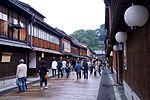
| Higashiyama-higashi (金沢市東山ひがし, Kanazawa-shi Higashiyama-higashi)[38] | tea house quarter | 1 | 1.8 ha (4.4 acres) |
Tea house neighborhood with two-storied houses that was created in 1820 by moving buildings from central Kanazawa. | Kanazawa, Ishikawa 36°34′21.64″N 136°40′1.33″E / 36.5726778°N 136.6670361°E |
|
| Kuroshima district (輪島市黒島地区, Wajima-shi kuroshima-chiku)[39] | ship-owner quarter | 2 | 20.5 ha (51 acres) |
Early 16th century settlement that grew with the development of the shipping industry in the Sea of Japan during the Edo period. The district contains residences of ship-owners and sailors, temples, shrines, storehouses and gardens. | Wajima, Ishikawa 37°16′53.96″N 136°44′4.39″E / 37.2816556°N 136.7345528°E |

|
| Shiramine (白山市白峰, Hakusan-shi Shiramine)[40] | sericulture community | 3 | 10.7 ha (26 acres) |
Sericultrue village in a narrow valley location. | Hakusan, Ishikawa 36°10′28.88″N 136°37′33.52″E / 36.1746889°N 136.6259778°E |

|
| Kumagawa-juku (若狭町熊川宿, Wakasa-chō Kumagawajuku)[41] | post town | 3 | 10.8 ha (27 acres) |
Located on the Saba Kaidō, which connected Wakasa Province with the capital in Kyoto. | Wakasa, Fukui 35°26′36.85″N 135°54′5.33″E / 35.4435694°N 135.9014806°E |

|
| Obama-nishigumi (小浜市小浜西組, Obama-shi Obama-nishigumi)[42] | merchant and tea house quarter | 2 | 19.1 ha (47 acres) |
Merchant houses and tea houses in an old port town that served as a relay point for goods from the Japan Sea side to Kyoto. | Obama, Fukui 35°29′32.05″N 135°44′13.69″E / 35.4922361°N 135.7371361°E |

|
| Imajō (南越前町今庄宿, Minamiechizen-chō Imajō)[43][44] | post town | 2 | 9.2 ha (23 acres) |
Minamiechizen, Fukui 35°46′25.29″N 136°11′47.08″E / 35.7736917°N 136.1964111°E |
—
| |
| Kamijō Shimo-odawara Enzan (甲州市塩山下小田原上条, Kōshū-shi Enzan Shimo-odawara Kamijō)[45] | mountain village and sericulture community | 3 | 15.1 ha (37 acres) |
Dry field farming village during the Edo period that turned into silk farming in the mid Meiji period. To accommodate the silk worm culture, the central part of the roof was raised. | Kōshū, Yamanashi 35°44′14.99″N 138°46′14.65″E / 35.7374972°N 138.7707361°E |

|
| Akazawa (早川町赤沢, Hayakawa-chō Akazawa)[46] | mountain village, post town for pilgrims | 3 | 25.6 ha (63 acres) |
Lodgings for pilgrims going to Kuon-ji, head temple of Nichiren-shū. Located between Mount Shichimen and the temple's sacred mountain, Mount Minobu. | Hayakawa, Yamanashi 35°23′50.74″N 138°22′39.08″E / 35.3974278°N 138.3775222°E |

|
| Narai (塩尻市奈良井, Shiojiri-shi Narai)[47] | post town | 3 | 17.6 ha (43 acres) |
Post station of the Nakasendō and largest of the Kisoji with buildings from the Edo until the Meiji period. | Shiojiri, Nagano 35°57′53.84″N 137°48′39.05″E / 35.9649556°N 137.8108472°E |

|
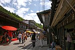
| Kiso-Hirasawa (塩尻市木曾平沢, Shiojiri-shi Kiso-hirasawa)[48] | lacquerware town | 2 | 12.5 ha (31 acres) |
Town houses and storehouse where Kiso lacquerware continues to be produced by traditional methods. | Shiojiri, Nagano 35°58′49.48″N 137°49′55.6″E / 35.9804111°N 137.832111°E |
|
| Inariyama (千曲市稲荷山, Chikuma-shi Inariyama)[49] | merchant quarter | 2 | 13 ha (32 acres) |
Originally founded during the Tenshō era as a castle town, Inariyama became a post station after the castle was abandoned in the Keichō era. Commercialization started in the 19th century and it turned into a distribution center for raw silk and textile products at the start of modern Japan. | Chikuma, Nagano 36°32′11.62″N 138°6′16.8″E / 36.5365611°N 138.104667°E |

|
| Togakushi (長野市戸隠, Nagano-shi Togakushi)[50] | temple lodging (shukubo), temple town | 2 | 73.3 ha (181 acres) |
Shukubo temple lodgings and houses of lay devotees around the lower and middle shrine of Togakushi Shrine. | Togakushi, Nagano 36°44′10.13″N 138°4′55.23″E / 36.7361472°N 138.0820083°E |
—
|
| Unno-juku (東御市海野宿, Tōmi-shi Unno-juku)[51] | post town and sericulture community | 1 | 13.2 ha (33 acres) |
Post station on the Hokkoku Kaidō established in 1625. From the Meiji period, the spacious rooms have been reused for silk farming. | Tōmi, Nagano 36°21′42.97″N 138°18′46.99″E / 36.3619361°N 138.3130528°E |

|
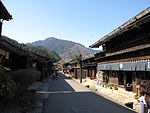
| Tsumago-juku (南木曽町妻籠宿, Nagiso-machi Tsumago-juku)[52] | post town | 3 | 1,245.4 ha (3,077 acres) |
One of the 69 Stations of the Nakasendō and part of the Kisoji. In addition to the late Edo early Meiji period inn town, the designation includes part of the rural surroundings and three villages. | Nagiso, Nagano 35°34′37.58″N 137°35′42.02″E / 35.5771056°N 137.5950056°E |
|
| Aoni (白馬村青鬼, Hakuba-mura Aoni)[53] | mountain village | 3 | 59.7 ha (148 acres) |
Small mountain village with thatched houses and storehouses, about 200 rice fields, an irrigation channel from the late Edo, early Meiji period. | Hakuba, Nagano 36°43′12.93″N 137°53′48.58″E / 36.7202583°N 137.8968278°E |

|
| Suzaka (須坂市須坂, suzakashi suzaka)[26] | merchant quarter and silk spinning town | 1 | 18.3 ha (45 acres) |
Town that developed throughout the early modern period as a trading center and flourished in modern times with the rise of the silk industry. | Suzaka, Nagano 36°39′16.16″N 138°18′41.61″E / 36.6544889°N 138.3115583°E |
|
| Gujō Hachiman Kita-machi (郡上市郡上八幡北町, Gujō-shi Gujō Hachiman kitamachi)[54] | castle town | 3 | 14.1 ha (35 acres) |
Dense town of two-storied houses below Gujō Hachiman Castle with a water supply system surrounded on all sides by mountains and a river. | Gujō, Gifu 35°45′11.11″N 136°57′25.91″E / 35.7530861°N 136.9571972°E |

|
| Hondōri Iwamura-chō (恵那市岩村町本通り, Ena-shi Iwamura-chō hondōri)[55] | merchant quarter | 3 | 14.6 ha (36 acres) |
Merchant district of a former castle town that prospered during the Edo period as a political, cultural and economic center of the Tōnō region | Ena, Gifu 35°21′58.25″N 137°26′21.35″E / 35.3661806°N 137.4392639°E |

|
| Shimoninomachi and Ōshinmachi (高山市下二之町大新町, Takayama-shi Shimoninomachi Ōshinmachi)[56] | merchant quarter | 1 | 6.6 ha (16 acres) |
Edo and Meiji period merchant houses in a former castle town. | Takayama, Gifu 36°8′49.72″N 137°15′31.7″E / 36.1471444°N 137.258806°E |

|
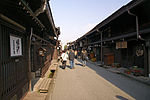
| Sanmachi (高山市三町, Takayama-shi Sanmachi)[57] | merchant quarter | 1 | 4.4 ha (11 acres) |
Edo period merchant houses in a former castle town. | Takayama, Gifu 36°8′28.13″N 137°15′38.19″E / 36.1411472°N 137.2606083°E |
|
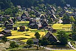
| Ogimachi (白川村荻町, Shirakawa-mura Ogimachi)[58] | mountain village | 3 | 45.6 ha (113 acres) |
Farming village with gasshō-zukuri houses, paddy and other fields. Part of the World Heritage Site Historic Villages of Shirakawa-gō and Gokayama | Shirakawa, Gifu 36°16′3.71″N 136°54′8.46″E / 36.2676972°N 136.9023500°E |
|
| Mino-machi (美濃市美濃町, Mino-shi Minomachi)[59] | merchant quarter | 1 | 9.3 ha (23 acres) |
Former castle town that prospered as a commercial center during the Edo period. | Mino, Gifu 35°32′43.75″N 136°54′43.54″E / 35.5454861°N 136.9120944°E |

|
| Hanazawa (焼津市花沢, Yaizu-shi hanazawa)[60] | mountain village | 3 | 19.5 ha (48 acres) |
Village located in a river valley along a former main transportation road farming citrus fruits, tea and tobacco using seasonally occupied farmwork huts. | Yaizu, Shizuoka 34°54′21.89″N 138°19′49.45″E / 34.9060806°N 138.3304028°E |

|
| Asuke (豊田市足助, Toyota-shi Asuke)[14] | merchant quarter | 1 | 21.5 ha (53 acres) |
An example of a commercial center in a mountain location that prospered through the circulation of goods. Large number of Edo period town houses . | Toyota, Aichi 35°8′13.26″N 137°19′12.17″E / 35.1370167°N 137.3200472°E |

|
| Arimatsu (名古屋市有松, Nagoya-shi Arimatsu)[61] | dyeing and weaving town | 1 | 7.3 ha (18 acres) |
Founded in 1608 where the Tōkaidō crosses the Owari Hills between Chiryū-juku and Narumi-juku, the town prospered through the invention of Arimatsu Shibori (tie-dye) which continues to be produced here. | Nagoya, Aichi 35°4′0.12″N 136°58′13.96″E / 35.0667000°N 136.9705444°E |

|
| Seki-juku (亀山市関宿, Kameyama-shi Sekijuku)[62] | post town | 3 | 25 ha (62 acres) |
Post station on the Tōkaidō extending for 1.8 km (1.1 mi) in east-west direction including two-storied town houses and the military headquarters. | Kameyama, Mie 34°51′7.78″N 136°23′27.19″E / 34.8521611°N 136.3908861°E |

|
| Hachiman (近江八幡市八幡, Ōmihachiman-shi Hachiman)[63] | merchant quarter | 1 | 13.1 ha (32 acres) |
Built on the east side of Lake Biwa at the intersection of the Hokkoku Kaidō with the Nakasendō the town was used as a base by Ōmi merchants which is reflected in the large number of elegant town and storehouses. | Ōmihachiman, Shiga 35°8′18.69″N 136°5′26.65″E / 35.1385250°N 136.0907361°E |

|
| Sakamoto (大津市坂本, Ōtsu-shi Sakamoto)[64] | monks' dwellings and temple town | 3 | 28.7 ha (71 acres) |
Temple town and study place for monks from Hiyoshi Taisha and Enryaku-ji. | Ōtsu, Shiga 35°4′14.25″N 135°52′16.1″E / 35.0706250°N 135.871139°E |

|
| Kawaramachi and Serimachi district (彦根市河原町芹町地区, Hikone-shi Kawaramachi Serimachi-chiku)[61] | merchant quarter | 2 | 5.0 ha (12 acres) |
Business district south east of the castle town of Hikone Castle that prospered from the Edo to the early Shōwa period. | Hikone, Shiga 35°15′47.71″N 136°15′28.87″E / 35.2632528°N 136.2580194°E |

|
| Gokashō-kondō (東近江市五個荘金堂, Higashiōmi-shi Gokashō-kondō)[65] | farming village | 3 | 32.2 ha (80 acres) |
Farming village with a core of residences of Ōmi merchants surrounded by traditional farm houses developed from the late Edo to the early Shōwa period. | Higashiōmi, Shiga 35°9′15.16″N 136°10′50.78″E / 35.1542111°N 136.1807722°E |

|
| Ine-ura (伊根町伊根浦, Ine-chō Ine-ura)[66] | fishing village | 3 | 310.2 ha (767 acres) |
Fishing village located on an inlet that is surrounded on three sides by mountains. Built from the late Edo to the early Shōwa period, the residential part of the town houses are built on top of the boat shed. | Ine, Kyoto 35°40′16.08″N 135°17′9.25″E / 35.6711333°N 135.2859028°E |

|
| Gion-shinbashi (京都市祇園新橋, Kyōto-shi Gion-shinbashi)[67] | tea house quarter | 1 | 1.4 ha (3.5 acres) |
Pleasure quarter centered around Shinbashi-dori with buildings constructed just after a great fire in 1865. | Kyoto, Kyoto 35°0′20.09″N 135°46′25.67″E / 35.0055806°N 135.7737972°E |

|
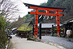
| Saga-Toriimoto (京都市嵯峨鳥居本, Kyōto-shi Saga-toriimoto)[68] | temple town | 3 | 2.6 ha (6.4 acres) |
Temple town with thatched houses centered around Adashino Nenbutsu-ji along the Atago Highway which leads to the Atago Shrine. | Kyoto, Kyoto 35°1′37.01″N 135°39′56.38″E / 35.0269472°N 135.6656611°E |
|
| Sannei-zaka (京都市産寧坂, Kyōto-shi Sannei-zaka)[69] | temple town | 3 | 8.2 ha (20 acres) |
Former temple town serving among others, Hokan-ji, Kiyomizu-dera and Yasaka Shrine. The stretch from Sannei-zaka towards Ninen-zaka is lined by single-storied shops and tea houses with mushikomado (虫籠窓) latticed windows. From Sannei-zaka to Kōdai-ji there are two-storied Taishō period buildings in sukiya-zukuri style. | Kyoto, Kyoto 34°59′56.81″N 135°46′50.62″E / 34.9991139°N 135.7807278°E |

|
| Kamigamo (京都市上賀茂, Kyōto-shi Kamigamo)[70] | shrine quarter | 3 | 2.7 ha (6.7 acres) |
Residential neighborhood for the head priests of Kamigamo Shrine including a stone bridge, earthen walls, gates, front gardens and single storied houses with sangawarabuki tile roofs,[note 7] | Kyoto, Kyoto 35°3′28.19″N 135°45′18.73″E / 35.0578306°N 135.7552028°E |

|
| Kita Miyama-chō (南丹市美山町北, Nantan-shi Miyama-chō Kita)[72] | mountain village | 3 | 127.5 ha (315 acres) |
Village with about 50 thatched roof houses and hardened stone walls extending for about 600 m × 300 m (1,970 ft × 980 ft) along the upper stream of the Yura River. | Nantan, Kyoto 35°18′48.3″N 135°37′23.58″E / 35.313417°N 135.6232167°E |

|
| Kaya (与謝野町加悦, Yosano-chō Kaya)[73] | textile town | 2 | 12 ha (30 acres) |
Former castle town that developed in early modern Japan until the early Shōwa period as a production center for Tango chirimen silk crêpe. | Yosano, Kyoto 35°30′16.13″N 135°5′33.63″E / 35.5044806°N 135.0926750°E |

|
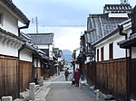
| Tondabayashi (富田林市富田林, Tondabayashi-shi Tondabayashi)[16][74] | jinaimachi town,[note 2] zaigō town[note 3] | 1 | 11.2 ha (28 acres) |
Founded as an Ikkō Jōdo Shinshū jinaimachi in the late Muromachi period on a terrace of the Ishi river and centered around Kōshō-ji Betsuin temple. In the Edo period it became a zaigō town with large town houses lining the street. | Tondabayashi, Osaka 34°30′1.41″N 135°36′4.25″E / 34.5003917°N 135.6011806°E |
|
| Sasayama (篠山市篠山, Sasayama-shi Sasayama)[75] | castle town | 2 | 40.2 ha (99 acres) |
Samurai houses, merchant houses and the early Edo period Sasayama Castle founded by Tokugawa Ieyasu. | Sasayama, Hyōgo 35°4′16.4″N 135°13′18.89″E / 35.071222°N 135.2219139°E |

|
| Fukusumi (篠山市福住, Sasayama-shi Fukusumi)[76] | post town, farming village | 豊岡市出石3 | 25.2 ha (62 acres) |
Post town and farming community that developed along a major road with two storied tile roofed and single storied thatched houses, with entrances on the gable end. | Sasayama, Hyōgo 35°4′20.49″N 135°21′27.25″E / 35.0723583°N 135.3575694°E |

|
| Ōya-chō Ōsugi (養父市大屋町大杉, yabu-shi ōya-chō ōsugi)[77][78] | mountain village and sericulture community | 3 | 5.8 ha (14 acres) |
Formerly one of the leading silk farming centers in Tajima Province prospering from the late Meiji to the early Shōwa period. | Yabu, Hyōgo 35°19′52.46″N 134°39′2.95″E / 35.3312389°N 134.6508194°E |
|
| Kitano-chō and Yamamoto-dōri (神戸市北野町山本通, Kōbe-shi Kitano-chō Yamamoto-dōri)[79] | port quarter | 1 | 9.3 ha (23 acres) |
District of foreign residences from the late Meiji and early Taishō Period that were established after the opening of the Port of Kobe in 1867. | Kōbe, Hyōgo 34°42′1.39″N 135°11′20.94″E / 34.7003861°N 135.1891500°E |

|
| Izushi (豊岡市出石, Toyooka-shi Izushi) | castle town | 2 | 23.1 ha (57 acres) |
Town houses, temples, shrines, and samurai residences, that appeared in connection with the construction of Izushi Castle by Koide Yoshihide in 1604. | Toyooka, Hyōgo 35°27′46.68″N 134°52′26.79″E / 35.4629667°N 134.8741083°E |

|
| Tatsuno (たつの市龍野, Tatsuno-shi Tatsuno)[80] | merchant quarter and brewers quarter | 1 | 15.9 ha (39 acres) |
Castle town beneath Tatsuno Castle that developed into a merchant district during the Edo period and a major producer of soy sauce with a tradition dating back to the 17th century. | Tatsuno, Hyōgo 34°51′59.21″N 134°32′47.84″E / 34.8664472°N 134.5466222°E |
|
| Matsuyama (宇陀市松山, Uda-shi Matsuyama)[81] | merchant quarter | 1 | 17 ha (42 acres) |
Located between Mount Shiroyama and the Uda River, Matsuyama developed from a castle town to a political and economic center of the Uda District. The town houses date from the late Edo to the early Shōwa period. | Uda, Nara 34°28′45.87″N 135°55′58.57″E / 34.4794083°N 135.9329361°E |

|
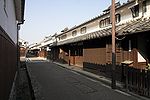
| Imai-chō (橿原市今井町, Kashihara-shi Imai-chō)[82] | jinaimachi town,[note 2] zaigō town[note 3] | 1 | 17.4 ha (43 acres) |
Originating as an autonomous religious community centered around Shōnen-ji (称念寺) during the Muromachi Period, the town was formerly surrounded by a moat. | Kashihara, Nara 34°30′25.86″N 135°47′10.35″E / 34.5071833°N 135.7862083°E |
|
| Gojō-shinmachi (五條市五條新町, Gojō-shi Gojō-shinmachi) | merchant quarter | 1 | 7 ha (17 acres) |
Large number of Edo period town houses of a flourishing merchant town of south Yamato. | Gojō, Nara 34°20′53.94″N 135°41′31.78″E / 34.3483167°N 135.6921611°E |

|
| Yuasa (湯浅町湯浅, Yuasa-chō Yuasa)[83] | brewers quarter | 2 | 6.3 ha (16 acres) |
Soy sauce maker district that flourished at the end of the 16th century, with shops and storehouses dating to the Edo period, the oldest are two-storied structures with gabled roof and hongawara tiles[note 8] | Yuasa, Wakayama 34°2′11.68″N 135°10′28.56″E / 34.0365778°N 135.1746000°E |

|
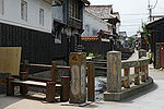
| Utsubuki-tamagawa (倉吉市打吹玉川, Kurayoshi-shi Utsubuki-tamagawa)[85] | merchant quarter | 1 | 9.2 ha (23 acres) |
Commercial and industrial city that prospered from the Edo to the Taishō period. The preservation district consists of town house, storehouses with white plaster walls and reddish roofs. | Kurayoshi, Tottori 35°25′56.1″N 133°49′23.12″E / 35.432250°N 133.8230889°E |
|
| Tokorogo (大山町所子, Daisen-chō Tokorogo)[86] | farming village | 3 | 25.8 ha (64 acres) |
Farming village with river irrigation from the Amida River, consisting of large scale main buildings and affiliated houses from the early modern period until the early Shōwa period including the Kadowaki Family House (門脇家住宅). | Daisen, Tottori 35°28′58.99″N 133°28′0.81″E / 35.4830528°N 133.4668917°E |

|
| Wakasa (若桜町若桜, Wakasa-chō Wakasa)[44] | merchant quarter | 3 | 9.5 ha (23 acres) |
Wakasa, Yazu District Tottori 35°20′38.25″N 134°23′51.13″E / 35.3439583°N 134.3975361°E |
—
| |
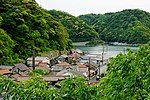
| Yunotsu (大田市温泉津, Ōda-shi Yunotsu)[87] | port quarter, hot-spring town | 2 | 36.6 ha (90 acres) |
The hot spring area developed from medieval times as port for the Iwami Ginzan Silver Mine (a World Heritage Site). The current townscape of hot spring ryokan located in a narrow and steep valley date from the late Edo to the early Shōwa period. | Ōda, Shimane 35°5′44.3″N 132°20′52.12″E / 35.095639°N 132.3478111°E |
|
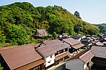
| Ōmori-ginzan (大田市大森銀山, Ōda-shi Ōmori-ginzan)[88] | mining town | 3 | 162.7 ha (402 acres) |
Townscape around the Iwami Ginzan Silver Mine (a World Heritage Site) with a mixture of samurai residences and town houses built from the Edo period onward. | Ōda, Shimane 35°6′51.31″N 132°26′42.9″E / 35.1142528°N 132.445250°E |
|
| Tsuwano (津和野町津和野, Tsuwano-chō Tsuwano)[89] | samurai quarter, merchant quarter | 2 | 11.1 ha (27 acres) |
Developed in the early Edo period as a castle town of Tsuwano Castle, Tsuwano contains residences of senior vassals and a merchant district centered along the old San'indō. | Tsuwano, Shimane 34°27′59.12″N 131°46′19.02″E / 34.4664222°N 131.7719500°E |

|
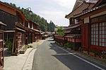
| Fukiya (高梁市吹屋, Takahashi-shi Fukiya)[90] | mining town | 3 | 6.4 ha (16 acres) |
Copper mining town and leading producer of copper in Chūgoku from the Muromachi to the Meiji period. With the decline of copper production in the Edo period, production shifted to Red Iron Oxide (Bengala) which prospered until the Taishō period. The houses feature red clay tile roofs, rouge mud walls and latticework. | Takahashi, Okayama 34°51′39.96″N 133°28′13.64″E / 34.8611000°N 133.4704556°E |
|
| Kurashiki-gawahan (倉敷市倉敷川畔, Kurashiki-shi Kurashiki-gawahan)[91] | merchant quarter | 1 | 15 ha (37 acres) |
Founded by Ukita Hideie, it later became the port of the Bitchū-Matsuyama Domain and served as relay point for goods to Kyoto. The townscape consists of glazed tile roofs and canals. | Kurashiki, Okayama 34°35′46.96″N 133°46′17.34″E / 34.5963778°N 133.7714833°E |

|
| Jōsai (津山市城西, Tsuyama-shi Jōsai)[92] | merchant quarter, temple town | 2 | 12 ha (30 acres) |
Edo period temple town with large scale temples in the western part of the old castle town and a commercial district along the Izumo Kaidō. | Tsuyama, Okayama 35°4′8.86″N 134°0′15.61″E / 35.0691278°N 134.0043361°E |
—
|
| Jōtō (津山市城東, Tsuyama-shi Jōtō)[93] | merchant quarter | 1 | 8.1 ha (20 acres) |
Merchant district that developed from the castle town of Tsuyama Castle, with buildings constructed from the Edo to the Shōwa period, featuring kōshiirimado (格子入窓) and mushikomado (虫籠窓) latticed windows, namako walls and sodekabe (袖壁) side walls. | Tsuyama, Okayama 35°3′45.55″N 134°0′51.55″E / 35.0626528°N 134.0143194°E |

|
| Yakage (矢掛町矢掛宿, Yakage-chō Yakage-juku)[94] | post town | 2 | 11.5 ha (28 acres) |
Post station on the San'yōdō containing a sub-honjin from the Edo period. | Yakage, Okayama 34°38′5.9″N 133°34′37.21″E / 34.634972°N 133.5770028°E |

|
| Mitarai Yutaka-machi (呉市豊町御手洗, Kure-shi Yutaka-machi Mitarai)[95] | port quarter | 2 | 6.9 ha (17 acres) |
With the development of the Western Circuit (西廻り航路, nishimawari kōro) shipping route through the Seto Inland Sea in the Edo period, Yutaka-machi Mitarai on the island of Ōsakishimojima grew as a port for ships waiting for rising tide or favourable winds. The town includes gabled houses with sangawarabuki roofs[note 7] and is dotted with western style house. The port area retains its historical character with groynes, stepped piers and a lighthouse. | Kure, Hiroshima 34°10′45.57″N 132°52′1.7″E / 34.1793250°N 132.867139°E |

|
| Takehara district (竹原市竹原地区, Takehara-shi Takehara-chiku)[96] | salt works town | 1 | 5 ha (12 acres) |
Market and port town that prospered with the introduction of salt pans in 1650. From the late Edo period and backed by the economic development the town became a center of learning, tea ceremony and other refined cultural activities. The current townscape with hongawarabuki roofs[note 8] and solid plastered fire-resistant wall (漆喰塗籠, shikkui nurigome) dates from the Edo to the early Shōwa period. | Takehara, Hiroshima 34°20′48.45″N 132°54′36.08″E / 34.3467917°N 132.9100222°E |

|
| Tomo-chō (福山市鞆町, fukuyama-shi tomo-chō)[97] | port quarter | 2 | 8.6 ha (21 acres) |
Port town along the main shipping routes along the Seto Inland Sea with Edo period town houses, temples, shrines, stone structures and harbour facilities. | Fukuyama, Hiroshima 34°23′1.36″N 133°22′54.37″E / 34.3837111°N 133.3817694°E | |
| Miyajima (廿日市市宮島町, Hatsukaichi-shi Miyajima-chō)[44] | temple town | 2 | 16.8 ha (42 acres) |
Miyajima, Hatsukaichi, Hiroshima 34°17′49.76″N 132°19′14.99″E / 34.2971556°N 132.3208306°E |
—
| |
| Hamasaki (萩市浜崎, Hagi-shi Hamasaki)[98] | port quarter | 2 | 10.3 ha (25 acres) |
Port town formed together with a castle town at the mouth of the Abu River. It flourished in early modern Japan in the shipbuilding and fishery industry and prospered from the Taishō to the early Shōwa period as a trading center for small dried sardines (イリコ) and Natsumikan. | Hagi, Yamaguchi 34°25′10.02″N 131°24′0.24″E / 34.4194500°N 131.4000667°E |

|
| Hiyako district (萩市平安古地区, Hagi-shi Hiyako-chiku)[99] | samurai quarter | 2 | 4 ha (9.9 acres) |
Samurai residences near the Hashimoto River that were created with the development of the castle. In addition to residential architecture the district includes a Nagayamon gate and storehouses. | Hagi, Yamaguchi 34°24′14.07″N 131°23′20.85″E / 34.4039083°N 131.3891250°E |

|
| Horiuchi district (萩市堀内地区, Hagi-shi Horiuchi-chiku)[100] | samurai quarter | 2 | 77.4 ha (191 acres) |
This district covers almost the whole area of the third bailey of Hagi Castle founded by Mōri Terumoto in 1608. It contained the domain's offices and residences of Mōri's household and high ranked samurai. | Hagi, Yamaguchi 34°24′45.96″N 131°23′13.66″E / 34.4127667°N 131.3871278°E |

|
| Sasanamiichi (萩市佐々並市, Hagi-shi Sasanamiichi)[14] | post town | 2 | 20.8 ha (51 acres) |
A former post town set among rice fields and situated along the main highway of the Hagi Domain. The town was redeveloped by the appearance of tea houses in early modern times. Houses with thatched and sangawarabuki roofs[note 7] | Hagi, Yamaguchi 34°17′13.66″N 131°27′48.2″E / 34.2871278°N 131.463389°E |

|
| Furuichi and Kanaya (柳井市古市金屋, Yanai-shi Furuichi-Kanaya)[101] | merchant quarter | 1 | 1.7 ha (4.2 acres) |
Due to its strategic location on the Seto Inland Sea and on Yanai River, Yanai flourished since ancient times as a trading center. Merchant houses with hongawarabuki roofs[note 8] and solid plastered fire-resistant wall (漆喰塗籠, shikkui nurigome). | Yanai, Yamaguchi 33°58′9.63″N 132°6′29.92″E / 33.9693417°N 132.1083111°E |

|
| Ochiai Higashiiyayama-son (三好市東祖谷山村落合, Miyoshi-shi Higashiiyayamason Ochiai)[102] | mountain village | 3 | 32.3 ha (80 acres) |
Village and farmland on a steep mountain slope supported by dry-stone walls with private houses dating to the 18th century. | Miyoshi, Tokushima 33°52′56.69″N 133°56′3.65″E / 33.8824139°N 133.9343472°E |

|
| Minami-machi Wakimachi (美馬市脇町南町, Wakimachi Minami-machi)[103] | merchant quarter | 1 | 5.3 ha (13 acres) |
A district that preserves private houses from each period after the beginning of the 18th century. The houses have a distinctive design with tile roofs, decorative udatsu (卯建) posts and the frame cased in a fireproof coat of plaster (大壁造, ōkabe-zukuri). | Mima, Tokushima 34°4′7.5″N 134°8′47.63″E / 34.068750°N 134.1465639°E |

|
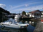
| Mugi, Teba Island (牟岐町出羽島, Mugi-chō Teba-jima) | fishing village | 3 | 3.7 ha (9.1 acres) |
Fishing village formed around a cove at the northern end of Teba Island from 1800 due to the immigration policy of the Tokushima Domain. From the Meiji to the prewar Shōwa period it prospered through bonito and tuna fishing. | Teba Island, Mugi, Tokushima 33°38′13″N 134°25′25.52″E / 33.63694°N 134.4237556°E |
|
| Kasajima Shiwakuhonjima-chō (丸亀市塩飽本島町笠島, Marugame-shi Shiwakuhonjima-chō Kasajima)[104] | port quarter | 3 | 13.1 ha (32 acres) |
A former castle town with houses from the mid-Edo to the Meiji period, where members of the Shiwaku Suigun lived. | Marugame, Kagawa 34°23′40.02″N 133°47′15.28″E / 34.3944500°N 133.7875778°E |

|
| Unomachi Uwa-chō (西予市宇和町卯之町, Seiyo-shi Uwa-chō Unomachi)[105] | zaigō town[note 3] | 2 | 4.9 ha (12 acres) |
Former zaigō hometown of the Uwajima Domain originating from a castle town of Matsuba Castle (松葉城) that functioned during the Edo period as a trading center for agricultural produce and hinoki cypress as well as a post station on the Uwajima road and gateway to Meiseki-ji on the Shikoku Pilgrimage. The preservation district includes remains of town houses from the Edo to the Shōwa Period as well as western style churches and schools. | Seiyo, Ehime 33°21′50.15″N 132°30′42.83″E / 33.3639306°N 132.5118972°E |

|
| Yōkaichi-gokoku (内子町八日市護国, Uchiko-chō Yōkaichi-gokoku)[106] | wax maker quarter | 3 | 3.5 ha (8.6 acres) |
Wax maker town with houses from the Edo and Meiji Period that developed along the Konpira road of the Shikoku Pilgrimage. The buildings line a 750 m (2,460 ft) long street and have plastered fireproof walls (漆喰塗大壁). | Uchiko, Ehime 33°33′24.37″N 132°39′12.43″E / 33.5567694°N 132.6534528°E |

|
| Iwamatsu Tsushima-chō (宇和島市津島町岩松, Uwajima-shi Tsuchima-chō Iwamatsu)[107] | zaigō town[note 3] | 3 | 10.6 ha (26 acres) |
Distribution center for goods that developed from the late Edo period to modern times on a narrow site near the mouth of the Iwamatsu river. The site includes townhouses, storehouses, outbuildings and farmhouses as well as the walls of waterways. | Uwajima, Ehime 33°7′24.6″N 132°31′21.72″E / 33.123500°N 132.5227000°E |
—
|
| Doikachū (安芸市土居廓中, Aki-shi Doikachū)[108] | samurai quarter | 2 | 9.2 ha (23 acres) |
Samurai town with narrow ordered streets, hedges, fences and houses from the late Edo to the early Shōwa period. | Aki, Kōchi 33°31′10.41″N 133°54′44.78″E / 33.5195583°N 133.9124389°E |

|
| Kiragawa-chō (室戸市吉良川町, Muroto-shi Kiragawa-chō)[109] | zaigō town[note 3] | 1 | 18.3 ha (45 acres) |
Residential town with merchant and store houses on a narrow plot along the road connecting Kōchi with Muroto. Buildings have white plastered walls and characteristic water-draining tiles (水切り瓦). | Muroto, Kōchi 33°19′52.9″N 134°5′56.3″E / 33.331361°N 134.098972°E |

|
| Niikawa and Tagomori (うきは市新川田篭, Ukiha-shi Niikawa Tagomori)[110] | mountain village | 3 | 71.2 ha (176 acres) |
Villages with irrigation channel rice farming along the Kumanoue River valley in the Minō Mountains. The villages contain houses with thatched yosemune style [note 9] roofs as well as irimoya style tile-roofed houses that gained popularity starting in the Meiji period. In addition the preservation district includes stone walls, main and wayside Shinto shrines. | Ukiha, Fukuoka 33°16′36.41″N 130°49′56.04″E / 33.2767806°N 130.8322333°E |

|
| Chikugo-yoshii (うきは市筑後吉井, Ukiha-shi Chikugo-yoshii)[112] | zaigō town[note 3] | 3 | 20.7 ha (51 acres) |
A former post station along the Bungo Road that, in the second half of the Edo period, developed into a residential town and economic center of the Chikugo district. After a large fire in 1867, houses received plaster fireproofing walls. | Ukiha, Fukuoka 33°20′33.56″N 130°45′26.83″E / 33.3426556°N 130.7574528°E |

|
| Kurogi (八女市黒木, Yame-shi Kurogi)[113] | zaigō town[note 3] | 3 | 18.4 ha (45 acres) |
Rural town with water irrigation channels. | Yame, Fukuoka 33°12′45.56″N 130°40′9.89″E / 33.2126556°N 130.6694139°E |

|
| Akizuki (朝倉市秋月, Asakura-shi Akizuki)[114] | castle town | 2 | 58.6 ha (145 acres) |
Former castle town of the Akizuki branch of the Kuroda clan established in the early Edo period. The district includes merchant houses and residences of samurai and of Shinto priests. | Asakura, Fukuoka 33°28′5.5″N 130°41′30.07″E / 33.468194°N 130.6916861°E |

|
| Yame-fukushima (八女市八女福島, Yame-shi Yame-fukushima)[115] | merchant quarter | 2 | 19.8 ha (49 acres) |
Townscape with storehouses in a former castle town of the Yanagawa Domain Fukushima Castle. Later with the abandonment of the castle it was taken over by the Kurume Domain and flourished as a trading center for locally produced agricultural products. | Yame, Fukuoka 33°12′40.18″N 130°33′42.18″E / 33.2111611°N 130.5617167°E |

|
| Shiotatsu (嬉野市塩田津, Ureshino-shi Shiotatsu)[116] | merchant quarter | 2 | 12.8 ha (32 acres) |
Former river port town utilizing the tidal movement which flourished as a trading center for rice, ceramics, raw materials and Amakusa pottery. | Ureshino, Saga 33°7′50.91″N 130°3′36.05″E / 33.1308083°N 130.0600139°E |

|
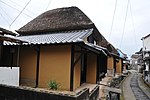
| Hamashozu-machi and Hamakanaya-machi (鹿島市浜庄津町浜金屋町, Kashima-shi Hamashōzu-machi Hamakanaya-machi)[117] | port quarter and zaigō town[note 3] | 2 | 2 ha (4.9 acres) |
Districts with thatched and sangawarabuki roofs[note 7] that developed in connection with a river port. | Kashima, Saga 33°5′27.72″N 130°7′12.93″E / 33.0910333°N 130.1202583°E |
|
| Hachihongi-shuku Hamanaka-machi (鹿島市浜中町八本木宿, Kashima-shi Hamanaka-machi Hachihongi-shuku)[118] | brewers town | 1 | 6.7 ha (17 acres) |
Town on the Nagasaki Kaidō where sake brewing became popular in the mid Edo period and towards the late Edo period there were around ten buildings involved in this business. The remaining structures date from the late Edo to the Shōwa period. | Kashima, Saga 33°5′34.43″N 130°6′53.96″E / 33.0928972°N 130.1149889°E |

|
| Arita-uchiyama (有田町有田内山, Arita-machi Arita-uchiyama)[119] | porcelain-maker town | 3 | 15.9 ha (39 acres) |
Arita's townscape was formed after the great Bunsei era fire of 1828 and consists of a mixture of machiya town houses and western architecture. | Arita, Saga 33°11′23.03″N 129°53′52.37″E / 33.1897306°N 129.8978806°E |

|
| Kōjiro-kūji (雲仙市神代小路, Unzen-shi Kōjiro-kūji)[120] | samurai quarter | 2 | 9.8 ha (24 acres) |
Edo period samurai district centered around the Nabeshima Residence including waterways, stone walls and hedges. | Unzen, Nagasaki 32°52′7.62″N 130°16′3.27″E / 32.8687833°N 130.2675750°E |

|
| Higashi-yamate (長崎市東山手, Nagasaki-shi Higashi-yamate)[121] | port quarter | 2 | 7.5 ha (19 acres) |
Stone paving, brick walls and western houses from the Meiji to the Taishō period along the Dutch Slope. | Nagasaki, Nagasaki 32°44′13.89″N 129°52′26.08″E / 32.7371917°N 129.8739111°E |

|
| Minami-yamate (長崎市南山手, Nagasaki-shi Minami-yamate)[122] | port quarter | 2 | 17 ha (42 acres) |
Foreign settlement that opened during the bakmatsu on a gentle slope with western style houses from the end of the Edo to the Meiji period. | Nagasaki, Nagasaki 32°43′58.44″N 129°52′7.08″E / 32.7329000°N 129.8686333°E |

|
| Kōnoura Ōshima-mura (平戸市大島村神浦, Hirado-shi Ōshima-mura Kōnoura)[123] | port quarter | 2 | 21.2 ha (52 acres) |
In the middle ages, the port of call of kenminsen in the Genkai Sea and later the headquarter of the whaling industry. The town includes gabled houses with sangawarabuki roofs[note 7] and trapezoidal floor plans matching the curved streets. | Hirado, Nagasaki 33°28′42.46″N 129°33′24.13″E / 33.4784611°N 129.5567028°E |

|
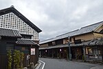
| Mameda-machi (日田市豆田町, Hita-shi Mameda-machi)[124] | merchant quarter | 2 | 10.7 ha (26 acres) |
Developed from a castle town to the political and economical center of Kyushu after becoming under the jurisdiction of the bakufu shogunate in 1639. Houses from different eras are preserved and form an orderly townscape with two streets running north-south crossed by five streets in east-west direction. | Hita, Ōita 33°19′38.51″N 130°56′12.47″E / 33.3273639°N 130.9367972°E |
|
| Kita-dai and Minami-dai (杵築市北台南台, Kitsuki-shi kita-dai minami-dai)[97] | samurai quarter | 2 | 16.1 ha (40 acres) |
Residential neighborhood for upper and middle-class samurai from the Kitsuki Domain around Kitsuki Castle. It consists of two parts, Kita-dai and Minami-dai separated by a valley and connected via stone steps and slopes of masonry. | Kitsuki, Ōita 33°24′59.77″N 131°37′5.54″E / 33.4166028°N 131.6182056°E |

|
| Tonegawa (椎葉村十根川, Shiibason Tonegawa)[125] | mountain village | 3 | 39.9 ha (99 acres) |
Settlement on a terraced hillside in the central part of the Kyushu mountain range. | Shiiba, Miyazaki 32°30′45.67″N 131°11′33.38″E / 32.5126861°N 131.1926056°E |

|
| Mimitsu (日向市美々津, Hyuga-shi Mimitsu)[126] | port quarter | 2 | 7.2 ha (18 acres) |
Port town that flourished as a ship building center from the bakumatsu to the Taishō period. The townscape consists of gabled houses along three main streets and fire prevention road known as tsukinuke. | Hyuga, Miyazaki 32°20′11.6″N 131°36′43.49″E / 32.336556°N 131.6120806°E |

|
| Obi (日南市飫肥, Nichinan-shi Obi)[127] | samurai quarter | 2 | 19.8 ha (49 acres) |
Samurai district of a former castle town of the Itō clan with stone walls, the castle front gate (大手門, ōtemon), gates for the samurai residences (長屋門, nagayamon) and other gates. | Nichinan, Miyazaki 31°37′36.21″N 131°21′11.46″E / 31.6267250°N 131.3531833°E |

|
| Iriki-fumoto (薩摩川内市入来麓, Satsumasendai-shi Iriki-fumoto)[128] | samurai quarter | 2 | 19.2 ha (47 acres) |
Samurai district with pebble fences and hedges on stone walls, located between Kiyoshiki Castle and the Hiwaki River. | Satsumasendai, Kagoshima 31°48′28.36″N 130°25′48.57″E / 31.8078778°N 130.4301583°E |

|
| Izumi-fumoto (出水市出水麓, Izumi-shi Izumi-fumoto)[129] | samurai quarter | 2 | 43.8 ha (108 acres) |
Oldest and largest among the outer castles established by the Satsuma Clan. | Izumi, Kagoshima 32°4′40.96″N 130°21′37.83″E / 32.0780444°N 130.3605083°E |

|
| Chiran (南九州市知覧, Minamikyūshū-shi Chiran)[130] | samurai quarter | 2 | 18.6 ha (46 acres) |
Part of the outer castles established by the Satsuma Clan and in possession of the Chiran-Shimazu Clan (Sata Clan), the district is centered around the feudal lord's residence. | Minamikyūshū, Kagoshima 31°22′41.27″N 130°26′44.81″E / 31.3781306°N 130.4457806°E |

|
| Kasedafumoto (南さつま市加世田麓, Minamisatsuma-shi Kasedafumoto)[80] | samurai quarter | 2 | 20.0 ha (49 acres) |
An outer castle in possession of the Shimazu clan since the 15th century. | Minamisatsuma, Kagoshima 31°24′48.92″N 130°19′8.75″E / 31.4135889°N 130.3190972°E | |
| Tonaki Island (渡名喜村渡名喜島, Tonaki-son Tonaki-jima)[131] | farming village | 3 | 21.4 ha (53 acres) |
Village with red tile roofs and streets of white sand in the flat central part of Tonaki Island. | Tonaki, Okinawa 26°22′17.54″N 127°8′31.69″E / 26.3715389°N 127.1421361°E |

|
| Taketomi (竹富町竹富島, Taketomi-chō Taketomi-jima)[132] | farming village | 3 | 38.3 ha (95 acres) |
Traditional composition and arrangement of wooden one-storey residential houses with red tile roofs surrounded by stone walls. | Taketomi, Okinawa 24°19′49.14″N 124°5′11.86″E / 24.3303167°N 124.0866278°E |

|
See also
[edit]Notes
[edit]- ^ The total in this column is larger than the number of designated groups, because some of the designated properties belong to more than one type.
- ^ a b c A jinai-machi, jinai-chō (寺内町) is an autonomous religious community that appeared in the Muromachi Period.
- ^ a b c d e f g h i j k l m n During the Edo period, zaigō towns (在郷町, zaigō-machi) were areas in the countryside where artisans and merchants lived under the administration of a nearby village's magistrate (bugyō).
- ^ (chūmon-zukuri, 中門造): a type of minka, vernecular house, with one or more wings projecting at right angles from the main house[15]
- ^ (yakuimon, 薬医門): a gate with a gabled roof, two square or rectangular main posts and two square or circular secondary posts[18]
- ^ (sodegura, 袖蔵): a type of storehouse flanking the main shop with the roofs at right angles to the main building[19]
- ^ a b c d e (sangawarabuki, 桟瓦葺): a roof tile combining a broad concave tile with a semi-cylindrical convex tile into one tile. The tile is square undulating from concave to convex.[71]
- ^ a b c (hongawarabuki, 本瓦葺): a tile roof composed of flat broad concave tiles and semi-cylindrical convex tiles covering the seams of the former[84]
- ^ (yosemune-zukuri, 寄棟造): a hipped roof where the front and back are trapezoidal and the sides triangular in shape; in Japan generally used for buildings of less importance[111]
References
[edit]- ^ a b "Preservation and Utilization of Cultural Properties" (PDF). Agency for Cultural Affairs. 1 April 2011. p. 43. Archived from the original (PDF) on 19 January 2012. Retrieved 2012-02-20.
- ^ 重要伝統的建造物群保存地区選定基準 [Important Preservation Districts for Groups of Traditional Buildings selection criteria] (in Japanese). Tokyo: MEXT. Retrieved 2010-01-08.
- ^ 国指定文化財 データベース [Database of National Cultural Properties] (in Japanese). Agency for Cultural Affairs. 2008-11-01. Archived from the original on 2009-03-30. Retrieved 2009-04-16.
- ^ 伝統的建造物群保存地区について [Preservation District for Groups of Traditional Buildings] (in Japanese). Hakodate city. Retrieved 2017-12-21.
- ^ 函館市元町末広町 (港町 北海道) [Hakodate-shi Motomachi Suehiro-chō (Minatomachi Hokkaidō)]. Cultural Heritage Online (in Japanese). Agency for Cultural Affairs. Retrieved 2012-02-20.
- ^ 弘前市仲町 [Hirosaki Nakachō]. Cultural Heritage Online (in Japanese). Agency for Cultural Affairs. Retrieved 2010-01-08.
- ^ "Kuroishishinakamachi Cultural Heritage Online" 黒石市中町 [Kuroishi Nakamachi]. Cultural Heritage Online (in Japanese). Agency for Cultural Affairs. Retrieved 2010-01-08.
- ^ 城内諏訪小路 [Jōnai Suwa-kōji] (in Japanese). Kanegasaki town. Archived from the original on 2010-01-12. Retrieved 2010-01-08.
- ^ 村田町村田伝統的建造物群保存地区 [Murata Groups of Traditional Buildings] (in Japanese). Murata town. Retrieved 2015-09-22.
- ^ 増田 [Masuda] (in Japanese). Yokote city. Retrieved 2014-08-20.
- ^ "Masuda Town Tourist Agency". Masuda town. Retrieved 2017-11-29.
- ^ 角館 [Kakunodate] (in Japanese). Semboku city. Retrieved 2010-01-08.
- ^ 下郷町大内 (宿場町 福島) [Shimogō-machi Ōuchi-juku (Shimogō-machi Fukushima)]. Cultural Heritage Online (in Japanese). Agency for Cultural Affairs. Retrieved 2012-02-20.
- ^ a b c 重要伝統的建造物群保存地区の選定について [About selection of Important Preservation Districts for Groups of Traditional Buildings] (PDF). Press release (in Japanese). Agency for Cultural Affairs. Archived from the original (PDF) on 2011-06-30. Retrieved 2011-07-04.
- ^ "chuumon-zukuri". JAANUS – Japanese Architecture and Art Net User System. Retrieved 2017-11-29.
- ^ a b 重要伝統的建造物群保存地区の選定について [Designation of Important Preservation Districts for Groups of Traditional Buildings] (PDF) (in Japanese). Agency for Cultural Affairs. Retrieved 2018-05-18.
- ^ "Sakuragawashimakabe Cultural Heritage Online" 桜川市真壁 [Sakuragawa-shi Makabe]. Cultural Heritage Online (in Japanese). Agency for Cultural Affairs. Retrieved 2012-02-20.
- ^ "yakuimon". JAANUS – Japanese Architecture and Art Net User System. Retrieved 2017-11-29.
- ^ "sodegura". JAANUS – Japanese Architecture and Art Net User System. Retrieved 2017-11-29.
- ^ 栃木市嘉右衛門町伝統的建造物群保存地区 [Tochigi Kauemon-chō Preservation District for Groups of Traditional Buildings]. Cultural Heritage Online (in Japanese). Tochigi, Tochigi. Retrieved 2012-08-21.
- ^ 桐生新町伝統的建造物群保存地区 [Kiryū Shin Machi Preservation District for Groups of Traditional Buildings] (in Japanese). Kiryū. Archived from the original on 2012-12-20. Retrieved 2012-08-20.
- ^ 赤岩 [Akaiwa] (in Japanese). Kuni. Archived from the original on 2009-05-31. Retrieved 2010-01-08.
- ^ "Kuni-Akaiwa Important Preservation Districts for Groups of Historic Buildings". Gunma Prefecture. Retrieved 2017-12-23.
- ^ 川越市川越 [Kawagoe] (in Japanese). Agency for Cultural Affairs. Archived from the original on 2010-01-17. Retrieved 2010-01-08.
- ^ 佐原 [Sawara]. Cultural Heritage Online (in Japanese). Agency for Cultural Affairs. Archived from the original on 2011-07-23. Retrieved 2010-01-08.
- ^ a b 重要伝統的建造物群保存地区の選定について [About selection of Important Preservation Districts for Groups of Traditional Buildings] (PDF). Press release (in Japanese). Agency for Cultural Affairs. 2024-05-17. Retrieved 2024-05-23.
- ^ 宿根木 [Shukunegi]. Cultural Heritage Online (in Japanese). Agency for Cultural Affairs. Archived from the original on 2011-07-23. Retrieved 2010-01-08.
- ^ 金屋町 [Kanaya-machi] (in Japanese). Takaoka. Retrieved 2014-08-20.
- ^ 山町筋 [Yamachō-suji] (in Japanese). Takaoka. Archived from the original on 2011-07-16. Retrieved 2010-01-08.
- ^ 吉久 [Yoshihisa] (in Japanese). Takaoka. Archived from the original on 2021-01-28. Retrieved 2020-10-31.
- ^ 菅沼 [Suganuma]. Cultural Heritage Online (in Japanese). Agency for Cultural Affairs. Archived from the original on 2011-07-23. Retrieved 2010-01-08.
- ^ 相倉 [Ainokura]. Cultural Heritage Online (in Japanese). Agency for Cultural Affairs. Archived from the original on 2011-07-23. Retrieved 2010-01-08.
- ^ 加賀橋立 [Kaga-hashidate] (in Japanese). Denken. Retrieved 2010-01-08.
- ^ 加賀東谷 [Kaga-higashitani] (in Japanese). Denken. Retrieved 2012-02-13.
- ^ 卯辰山麓 [Utatsu-sanroku] (in Japanese). Denken. Retrieved 2012-02-13.
- ^ 寺町台 [Teramachi-dai] (in Japanese). Kanazawa city. Archived from the original on 2020-10-25. Retrieved 2014-08-20.
- ^ 主計町 [Kazue-machi] (in Japanese). Denken. Retrieved 2010-01-08.
- ^ 東山ひがし [Higashiyama-higashi] (in Japanese). Denken. Retrieved 2010-01-08.
- ^ 黒島地区 [Kuroshima district] (in Japanese). Ishikawa Prefecture. Retrieved 2010-01-08. [dead link]
- ^ 白峰 [Shiramine] (in Japanese). Hakusan. Archived from the original on 2012-10-16. Retrieved 2012-08-20.
- ^ 熊川宿 [Kumagawa-juku] (in Japanese). Kumagawa-juku. Retrieved 2010-01-08.
- ^ "Obamashiobamanishigumi Cultural Heritage Online" 小浜西組 [Obamanishigumi]. Cultural Heritage Online (in Japanese). Agency for Cultural Affairs. Retrieved 2011-07-04.
- ^ 南越前「今庄宿」 [Imajō, Minamiechizen-chō] (in Japanese). The Asahi Shimbun. 21 May 2021. Retrieved 2021-06-06.
- ^ a b c 重要伝統的建造物群保存地区の選定について [About selection of Important Preservation Districts for Groups of Traditional Buildings] (PDF). Press release (in Japanese). Agency for Cultural Affairs. Retrieved 2021-06-06.
- ^ 重伝建地区「甲州市塩山下小田原上条」 [Group of Traditional Buildings Kōshū-shi Enzan Shimo-odawara Kamijō] (in Japanese). Kōshū. Retrieved 2010-01-08.
- ^ 赤沢 [Akazawa] (in Japanese). Hayakawa. Archived from the original on 2010-01-04. Retrieved 2010-01-08.
- ^ 奈良井 [Narai] (in Japanese). Narai-juku tourism association. Retrieved 2010-01-08.
- ^ 木曾平沢 [Kiso-hirasawa] (in Japanese). Kiso-hirasawa preservation association. Retrieved 2010-01-08.
- ^ 稲荷山が重要伝統的建造物群保存地区として選定されました [Designation of Inariyama as Important Preservation District] (in Japanese). Chikuma city. Archived from the original on 2015-09-23. Retrieved 2015-09-22.
- ^ 長野市戸隠伝統的建造物群保存地区について [Designation of Nagano-shi Togakushi as Important Preservation District] (in Japanese). Nagano city. Retrieved 2017-05-29.
- ^ 海野宿 [Unno-juku] (in Japanese). Tōmi city Sightseeing Association. Archived from the original on 2009-12-28. Retrieved 2010-01-08.
- ^ 妻籠宿 [Tsumago-juku] (in Japanese). Tsumago Sightseeing Association. Archived from the original on 2010-02-02. Retrieved 2010-01-08.
- ^ 白馬村青鬼 [Aoni] (in Japanese). Agency for Cultural Affairs. Archived from the original on 2009-04-29. Retrieved 2010-01-08.
- ^ 郡上八幡北町 [Gujō Hachiman kitamachi] (in Japanese). Gujō city. Archived from the original on 2014-08-21. Retrieved 2014-08-20.
- ^ 岩村町本通り [Hondōri Iwamura-chō] (in Japanese). Ena city. Archived from the original on 2007-09-20. Retrieved 2010-01-08.
- ^ 高山市下二之町大新町 [Shimoninomachi Ōshinmachi] (in Japanese). Denken. Retrieved 2010-01-08.
- ^ 高山市三町 [Sanmachi] (in Japanese). Takayama city. Archived from the original on 2010-07-12. Retrieved 2010-01-08.
- ^ 白川村荻町 [Ogimachi] (in Japanese). Denken. Retrieved 2010-01-08.
- ^ 美濃市美濃町 [Minomachi] (in Japanese). Denken. Retrieved 2010-01-08.
- ^ 焼津市花沢伝統的建造物群保存地区の紹介 [Yaizu Hanazawa Group of Traditional Buildings] (in Japanese). Yaizu city. Archived from the original on 2015-09-23. Retrieved 2015-09-22.
- ^ a b 重要伝統的建造物群保存地区の選定について [About selection of Important Preservation Districts for Groups of Traditional Buildings] (PDF). Press release (in Japanese). Agency for Cultural Affairs. Archived from the original (PDF) on 2013-01-24. Retrieved 2016-07-27.
- ^ "Seki-juku". Mie Prefecture. Retrieved 2010-01-08.
- ^ 近江八幡市八幡 [Hachiman] (in Japanese). Ōmihachiman city. Archived from the original on October 24, 2007. Retrieved 2010-01-08.
- ^ 大津市坂本 [Sakamoto]. Cultural Heritage Online (in Japanese). Agency for Cultural Affairs. Archived from the original on 2011-07-23. Retrieved 2010-01-08.
- ^ 東近江市五個荘金堂 [Gokashō-kondō] (in Japanese). Higashiōmi city. Retrieved 2010-01-08.[permanent dead link]
- ^ 伊根町伊根浦 [Ine-ura] (in Japanese). Ine town. Retrieved 2010-01-08.[permanent dead link]
- ^ 京都市祇園新橋 [Gion Shinbashi] (in Japanese). Agency for Cultural Affairs. Archived from the original on 2009-04-29. Retrieved 2010-01-08.
- ^ 京都市嵯峨鳥居本 [Saga-Toriimoto] (in Japanese). Agency for Cultural Affairs. Archived from the original on 2009-04-29. Retrieved 2010-01-08.
- ^ 京都市産寧坂 [Sanneizaka] (in Japanese). Agency for Cultural Affairs. Archived from the original on 2009-04-29. Retrieved 2010-01-08.
- ^ 京都市上賀茂 [Kamigamo] (in Japanese). Agency for Cultural Affairs. Archived from the original on 2009-04-28. Retrieved 2010-01-08.
- ^ "sangawarabuki". JAANUS – Japanese Architecture and Art Net User System. Retrieved 2009-11-14.
- ^ 南丹市美山町北 [Miyama-chō Kita] (in Japanese). Agency for Cultural Affairs. Archived from the original on 2009-04-28. Retrieved 2010-01-08.
- ^ 与謝野町加悦 [Kaya] (in Japanese). Yosano town. Archived from the original on 2011-07-21. Retrieved 2010-01-08.
- ^ 富田林市富田林 [Tondabayashi] (in Japanese). Tondabayashi city. Retrieved 2010-01-08. [dead link]
- ^ 篠山市篠山 [Sasayama] (in Japanese). Sasayama city. Archived from the original on 2010-01-11. Retrieved 2010-01-08.
- ^ 篠山市福住 [Fukusumi] (in Japanese). Sasayama city. Archived from the original on 2014-08-22. Retrieved 2014-08-20.
- ^ 重要伝統的建造物群保存地区の選定について [Designation of Important Preservation Districts for Groups of Traditional Buildings] (PDF) (in Japanese). Agency for Cultural Affairs. Retrieved 2017-11-28.
- ^ 養父市大屋町大杉 [Ōya-chō Ōsugi]. Yabu city. Retrieved 2017-12-07.
- ^ 神戸市北野町山本通 [Kitano-chō and Yamamoto-dōri] (in Japanese). Kōbe city. Archived from the original on 2014-01-04. Retrieved 2010-01-08.
- ^ a b 重要伝統的建造物群保存地区の選定について [Designation of Important Preservation Districts for Groups of Traditional Buildings] (PDF) (in Japanese). Agency for Cultural Affairs. Retrieved 2019-10-19.
- ^ 宇陀市松山 [Matsuyama] (in Japanese). Uda city. Archived from the original on 2011-07-16. Retrieved 2010-01-08.
- ^ 橿原市今井町 [Imai-chō]. Cultural Heritage Online (in Japanese). Agency for Cultural Affairs. Archived from the original on 2011-07-23. Retrieved 2010-01-08.
- ^ 湯浅町湯浅 [Yuasa] (in Japanese). Yuasa town. Retrieved 2010-01-08.
- ^ "hongawarabuki". JAANUS – Japanese Architecture and Art Net User System. Retrieved 2009-11-19.
- ^ 倉吉市打吹玉川 [Utsubuki-tamagawa]. Cultural Heritage Online (in Japanese). Agency for Cultural Affairs. Archived from the original on 2011-07-23. Retrieved 2010-01-08.
- ^ 大山町所子 [Tokorogo] (in Japanese). Daisen city. Retrieved 2014-08-20.
- ^ 大田市温泉津 [Yunotsu] (in Japanese). Ōda city. Archived from the original on 2011-07-22. Retrieved 2010-01-08.
- ^ 大田市大森銀山 [Ōmori-ginzan] (in Japanese). Denken. Retrieved 2010-01-08.
- ^ 津和野 [Tsuwano] (in Japanese). Tsuwano town. Retrieved 2014-08-20.
- ^ 高梁市吹屋 [Fukiya] (in Japanese). Agency for Cultural Affairs. Archived from the original on 2009-04-29. Retrieved 2010-01-08.
- ^ 倉敷市倉敷川畔 [Kurashiki-gawahan] (in Japanese). Agency for Cultural Affairs. Retrieved 2010-01-08.
- ^ 津山市城西 [Jōsai] (in Japanese). Tsuyama city. Retrieved 2020-10-31.
- ^ 津山市城東 [Jōtō] (in Japanese). Tsuyama city. Retrieved 2014-08-20.
- ^ 矢掛宿 [Yakage] (in Japanese). Yakage. Retrieved 2020-10-31.
- ^ 呉市豊町御手洗 [Yutakamachi-mitarai] (in Japanese). Kure city. Retrieved 2017-12-10.
- ^ 竹原市竹原地区 [Takehara district] (in Japanese). Takehara city. Archived from the original on 2010-06-19. Retrieved 2010-01-08.
- ^ a b 重要伝統的建造物群保存地区の選定について [Designation of Important Preservation Districts for Groups of Traditional Buildings] (PDF) (in Japanese). Agency for Cultural Affairs. Retrieved 2017-11-28.
- ^ 萩市浜崎 [Hamasaki]. Cultural Heritage Online (in Japanese). Agency for Cultural Affairs. Retrieved 2010-01-08.
- ^ 萩市平安古地区 [Hiyako district]. Cultural Heritage Online (in Japanese). Agency for Cultural Affairs. Retrieved 2010-01-08.
- ^ 萩市堀内地区 [Horiuchi district]. Cultural Heritage Online (in Japanese). Agency for Cultural Affairs. Retrieved 2010-01-08.
- ^ 柳井市古市金屋 [Furuichi-Kanaya]. Cultural Heritage Online (in Japanese). Agency for Cultural Affairs. Retrieved 2010-01-08.
- ^ 三好市東祖谷山村落合 [Higashiiyayamason Ochiai] (in Japanese). Denken. Retrieved 2010-01-08.
- ^ 美馬市脇町南町 [Wakimachi Minami-machi] (in Japanese). Denken. Retrieved 2010-01-08.
- ^ 丸亀市塩飽本島町笠島 [Kasajima Shiwakuhonjima-chō] (in Japanese). Denken. Retrieved 2010-01-08.
- ^ 西予市宇和町卯之町 [Unomachi Uwa-chō]. Cultural Heritage Online (in Japanese). Agency for Cultural Affairs. Archived from the original on 2011-07-22. Retrieved 2010-01-08.
- ^ 内子町八日市護国 [Yōkaichi-gokoku]. Cultural Heritage Online (in Japanese). Agency for Cultural Affairs. Retrieved 2010-01-08.
- ^ 文化審議会の答申 [Report of the Agency for Cultural Affairs] (PDF). Cultural Heritage Online (in Japanese). Agency for Cultural Affairs. Retrieved 2023-11-24.
- ^ 安芸市土居廓中 [Aki-shi Doikachū] (in Japanese). Aki. Retrieved 2012-08-20.
- ^ 室戸市吉良川町 [Kiragawa-chō]. Cultural Heritage Online (in Japanese). Agency for Cultural Affairs. Retrieved 2010-01-08.
- ^ うきは市新川田篭 [Ukiha-shi Niikawa Tagomori] (in Japanese). Ukiha, Fukuoka. Retrieved 2012-08-20.
- ^ "yosemune-zukuri". JAANUS – Japanese Architecture and Art Net User System. Retrieved 2009-11-08.
- ^ うきは市筑後吉井 [Chikugo-yoshii]. Cultural Heritage Online (in Japanese). Agency for Cultural Affairs. Retrieved 2010-01-08.
- ^ 伝統的建造物群保存地区(八女福島および黒木) [Preservation districts for groups of traditional buildings (Yame, Fukushima and Kurogi)] (in Japanese). Yame city. Retrieved 2017-12-17.
- ^ 秋月伝統的建造物群保存地区 [Akizuki Preservation district for groups of traditional buildings] (in Japanese). Asakura city. Retrieved 2017-12-17.
- ^ 八女市八女福島 [Yame-fukushima]. Cultural Heritage Online (in Japanese). Agency for Cultural Affairs. Retrieved 2010-01-08.
- ^ 嬉野市塩田津 [Shiotatsu] (in Japanese). Denken. Retrieved 2010-01-08.
- ^ 鹿島市浜庄津町浜金屋町 [Hamashozumachi and Hamakanayamachi] (in Japanese). Denken. Retrieved 2010-01-08.
- ^ 鹿島市浜中町八本木宿 [Hachihongi-shuku] (in Japanese). Denken. Retrieved 2010-01-08.
- ^ 有田町有田内山 [Arita-uchiyama] (in Japanese). Denken. Retrieved 2010-01-08.
- ^ 神代小路重要歴史的建造物群保存地区 [Kōjiro-kūji Important Preservation District for Groups of Traditional Buildings] (in Japanese). Unzen city. Retrieved 2017-12-19.
- ^ 長崎市東山手 [Higashi-yamate]. Cultural Heritage Online (in Japanese). Agency for Cultural Affairs. Archived from the original on 2011-07-23. Retrieved 2010-01-08.
- ^ 長崎市南山手 [Minami-yamate]. Cultural Heritage Online (in Japanese). Agency for Cultural Affairs. Retrieved 2010-01-08.
- ^ 平戸市大島村神浦 [Kōnoura Ōshima-mura] (in Japanese). Hirado city. Archived from the original on 2011-06-12. Retrieved 2010-01-08.
- ^ 日田市豆田町伝統的建造物群保存地区 [Mameda-machi Preservation district for Groups of Traditional Buildings] (in Japanese). Hita. Retrieved 2017-12-19.
- ^ 椎葉村十根川 [Tonegawa]. Cultural Heritage Online (in Japanese). Agency for Cultural Affairs. Retrieved 2010-01-08.
- ^ 日向市美々津 [Mimitsu]. Cultural Heritage Online (in Japanese). Agency for Cultural Affairs. Retrieved 2010-01-08.
- ^ 日南市飫肥 [Obi]. Cultural Heritage Online (in Japanese). Agency for Cultural Affairs. Archived from the original on 2011-07-23. Retrieved 2010-01-08.
- ^ 薩摩川内市入来麓 [Iriki-fumoto]. Cultural Heritage Online (in Japanese). Agency for Cultural Affairs. Retrieved 2010-01-08.
- ^ 出水市出水麓 [Izumi-fumoto]. Cultural Heritage Online (in Japanese). Agency for Cultural Affairs. Archived from the original on 2011-07-23. Retrieved 2010-01-08.
- ^ 南九州市知覧 [Chiran]. Cultural Heritage Online (in Japanese). Agency for Cultural Affairs. Archived from the original on 2011-07-23. Retrieved 2010-01-08.
- ^ 渡名喜村渡名喜島 [Tonaki]. Cultural Heritage Online (in Japanese). Agency for Cultural Affairs. Retrieved 2010-01-08.
- ^ 竹富町竹富島 [Taketomi]. Cultural Heritage Online (in Japanese). Agency for Cultural Affairs. Archived from the original on 2011-07-23. Retrieved 2010-01-08.

