University Park–Emory Highlands–Emory Estates Historic District
This article lacks inline citations besides NRIS, a database which provides minimal and sometimes ambiguous information. Please help ensure the accuracy of the information in this article by providing inline citations to additional reliable sources. (November 2013) (Learn how and when to remove this message) |
University Park–Emory Highlands–Emory Estates Historic District | |
| Nearest city | Decatur, Georgia |
|---|---|
| Coordinates | 33°47′24″N 84°18′57″W / 33.79000°N 84.31583°W / 33.79000; -84.31583 |
| Area | 85 acres (34 ha) |
| Built | 1916 |
| Architect | O.F. Kauffman, J.T. Nash |
| Architectural style | Late 19th And Early 20th Century American Movements, Late 19th And 20th Century Revivals |
| NRHP reference No. | 97001638[1] |
| Added to NRHP | August 31, 1998 |
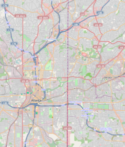
University Park–Emory Highlands–Emory Estates is a historic district listed on the National Register of Historic Places in the Druid Hills CDP adjacent to Emory University near Atlanta, Georgia.
The University Park tract broke ground in 1916 and consists of 65 houses along Emory and Ridgewood Drives.
Emory Highlands was laid out in 1923 and consists of 58 lots along Burlington Road and Ridgewood Drive between University and North Decatur Road.
Emory Estates was laid out in 1925 and consists of 73 lots on Emory Circle and Durand Drive. Houses here date from 1925 through 1943.
Architecture
[edit]Small, Craftsman-style bungalows and English Vernacular-style cottages are most common. There are also some larger, two-story Colonial Revival-style houses.
References
[edit]- Continuation Sheet, National Register of Historic Places - History and architecture of the district
| Topics | |
|---|---|
| Lists by state |
|
| Lists by insular areas | |
| Lists by associated state | |
| Other areas | |
| Related | |
| Origins | |
|---|---|
| Structures |
|
| Civil War | |
| Crime |
|
| Culture | |
| Disasters |
|
| Events |
|
| Labor |
|
| LGBT |
|
| People | |
| Places | |
| Protests |
|
| Transportation | |
| Architects | |
|---|---|
| Historic buildings | |
| Historic districts | |
| Institutions | |
| People | |
| Transportation | |
| Education |
|
| Other |
|
This article about a property in Georgia on the National Register of Historic Places is a stub. You can help Wikipedia by expanding it. |
- Houses on the National Register of Historic Places in Georgia (U.S. state)
- Geography of DeKalb County, Georgia
- Druid Hills, Georgia
- Bungalow architecture in Georgia (U.S. state)
- Houses in DeKalb County, Georgia
- Historic districts on the National Register of Historic Places in Georgia (U.S. state)
- National Register of Historic Places in DeKalb County, Georgia
- Georgia (U.S. state) Registered Historic Place stubs
- Pages using gadget WikiMiniAtlas
- Articles using NRISref without a reference number
- Articles with short description
- Short description matches Wikidata
- Articles sourced only to NRIS from November 2013
- All articles sourced only to NRIS
- Use American English from May 2021
- All Wikipedia articles written in American English
- Use mdy dates from May 2021
- Short description is different from Wikidata
- Coordinates on Wikidata
- NRHP infobox with nocat
- All stub articles


