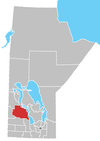
Ethelbert, Manitoba
Ethelbert is an unincorporated urban community in the Municipality of Ethelbert, Manitoba, Canada.
Originally incorporated as a village in 1950, the community was re-classified as an unincorporated urban community on 1 January 2015, following the municipal amalgamations in Manitoba.
Located near Duck Mountain Provincial Park on PTH 10, the community is 370 km (230 mi) northwest of Winnipeg and 60 km (37 mi) north of Dauphin, Manitoba. The primary industries of Ethelbert are agriculture, logging and tourism.
Demographics
[edit]In the 2021 Census of Population conducted by Statistics Canada, Ethelbert had a population of 314 living in 149 of its 175 total private dwellings, a change of 13.4% from its 2016, population of 277. With a land area of 2.66 km2 (1.03 sq mi), it had a population density of 118.0/km2 (305.7/sq mi) in 2021.[1]
Attractions
[edit]The Ethelbert and District Museum is open in the summer. The museum features a rich collection of many local artifacts as well as a gift shop.
Ethelbert is surrounded by hundreds of lakes which provide opportunities for fishing, swimming, and water sports like boating and kayaking. Nearby lakes include:
- Jackfish Lake[2]
- Spray Lake[3]
- Lake Winnipeg
Climate
[edit]Precipitation data from Environment Canada.[4]
| Climate data for Ethelbert | |||||||||||||
|---|---|---|---|---|---|---|---|---|---|---|---|---|---|
| Month | Jan | Feb | Mar | Apr | May | Jun | Jul | Aug | Sep | Oct | Nov | Dec | Year |
| Average precipitation mm (inches) | 19.4 (0.76) |
10.3 (0.41) |
23.0 (0.91) |
23.6 (0.93) |
52.0 (2.05) |
87.3 (3.44) |
76.4 (3.01) |
74.2 (2.92) |
58.6 (2.31) |
27.8 (1.09) |
22.1 (0.87) |
19.2 (0.76) |
493.8 (19.44) |
| Average rainfall mm (inches) | 0.0 (0.0) |
0.6 (0.02) |
4.2 (0.17) |
11.9 (0.47) |
50.2 (1.98) |
87.3 (3.44) |
76.4 (3.01) |
74.2 (2.92) |
58.6 (2.31) |
20.6 (0.81) |
2.0 (0.08) |
0.2 (0.01) |
386.0 (15.20) |
| Average snowfall cm (inches) | 19.4 (7.6) |
9.6 (3.8) |
18.7 (7.4) |
11.8 (4.6) |
1.8 (0.7) |
0.0 (0.0) |
0.0 (0.0) |
0.0 (0.0) |
0.0 (0.0) |
7.3 (2.9) |
20.1 (7.9) |
19.0 (7.5) |
107.7 (42.4) |
| Source: Environment Canada[5] | |||||||||||||
The climate in the summer is warm and humid with temperatures reaching 50 °F (10 °C) to 75 °F (24 °C) and humidity in the 90s. It usually rains for 6–8 days a month during the summer.
Climate in the winter is a whole different story with the temperature reaching 17 °F (-8 °C) to -15 °F (-26 °C). It rains about 5–6 days a month during the winter.
References
[edit]- ^ "Population and dwelling counts: Canada and designated places". Statistics Canada. February 9, 2022. Retrieved September 3, 2022.
- ^ "Jackfish Lake Trail". All Trails.
- ^ "Spray Lake |". Retrieved August 5, 2021.
- ^ "Ethelbert Weather". WorldWeatherOnline.com. Retrieved August 5, 2021.
- ^ "Ethelbert". Canadian Climate Normals 1981–2010 (in English and French). Environment Canada. October 31, 2011. Retrieved September 19, 2015.
51°31′36″N 100°23′34″W / 51.5268°N 100.3927°W


