Jonava City Eldership
Appearance
Jonava City Eldership
Jonavos miesto seniūnija | |
|---|---|
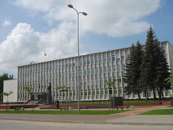
 Municipality and Eldership office | |
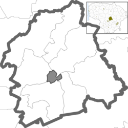
 Location of Jonava City eldership | |
| Coordinates: 55°04′44″N 24°17′06″E / 55.07889°N 24.28500°E | |
| Country | |
| Ethnographic region | Aukštaitija |
| County | |
| Municipality | |
| Administrative centre | Jonava |
| Area | |
• Total | 10.639 km2 (4.108 sq mi) |
| Population (2021) | |
• Total | 27,381 |
| • Density | 2,600/km2 (6,700/sq mi) |
| Time zone | UTC+2 (EET) |
| • Summer (DST) | UTC+3 (EEST) |
Jonava City Eldership (Lithuanian: Jonavos miesto seniūnija) is a Lithuanian eldership, located in a central part of Jonava District Municipality.[1][2]
Geography
[edit]Demography
[edit]
|
| ||||||||||||
| Source: 1902, 1923, 1959 & 1970, 1979, 1989, 2001, 20112021 | |||||||||||||
Elections
[edit]2023 municipality elections
[edit]| Political party | Municipality elections | |
|---|---|---|
| Votes [4] | %[5] | |
| Social Democratic Party of Lithuania | 6464 | 62.76% |
| Lithuanian Farmers and Greens Union | 776 | 7.53% |
| Liberals' Movement | 724 | 7.03% |
| Homeland Union | 612 | 5.94% |
| Political committee Our Jonava | 571 | 5.54% |
| Union of Democrats "For Lithuania" | 339 | 3.29% |
| Lithuanian Regions Party | 330 | 3.20% |
| Labour Party | 288 | 2.79% |
| Freedom Party (Lithuania) | 194 | 1.88% |
| Total registered voters: 22,337 | Turnout: 46.10% | |
References
[edit]- ^ "2011 census". Statistikos Departamentas (Lithuania). Retrieved August 21, 2017.
- ^ "Jonavos miesto seniūnija - Seniūnijos". lrvalstybe.lt. Retrieved 25 December 2020.
- ^ "Jonavos miesto seniūnija". jonava.lt. Retrieved 25 December 2020.
- ^ Rezultatai 2023
- ^ of all votes
