Knínice (Blansko District)
Knínice | |
|---|---|
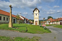
 Centre of Knínice | |
| Coordinates: 49°32′23″N 16°41′42″E / 49.53972°N 16.69500°E | |
| Country | |
| Region | South Moravian |
| District | Blansko |
| First mentioned | 1110 |
| Area | |
• Total | 11.20 km2 (4.32 sq mi) |
| Elevation | 377 m (1,237 ft) |
| Population (2024-01-01)[1] | |
• Total | 965 |
| • Density | 86/km2 (220/sq mi) |
| Time zone | UTC+1 (CET) |
| • Summer (DST) | UTC+2 (CEST) |
| Postal code | 679 34 |
| Website | www |
Knínice (until 2015 Knínice u Boskovic) is a market town in Blansko District in the South Moravian Region of the Czech Republic. It has about 1,000 inhabitants.
Etymology
[edit]The initial name of the settlement was Knihnice. The name was derived from the old Czech word kněhyně (in modern Czech kněžna), meaning 'princess'.[2]
Geography
[edit]Knínice is located about 19 kilometres (12 mi) north of Blansko and 36 km (22 mi) north of Brno. It lies on the border between the Boskovice Furrow and Drahany Highlands. The highest point is the hill Mojetín at 608 m (1,995 ft) above sea level. The Semíš Stream flows through the market town.
History
[edit]The village was founded by Queen Euphemia of Hungary. The first written mention of Knínice is from 1110, when Queen Euphemia donated the village to the Hradisko Monastery in Olomouc. The monastery owned Knínice until the abolition of the monastery in 1784. In 1250, Knínice was promoted to a market town by King Wenceslaus I.[2]
Demographics
[edit]
|
|
| ||||||||||||||||||||||||||||||||||||||||||||||||||||||
| Source: Censuses[3][4] | ||||||||||||||||||||||||||||||||||||||||||||||||||||||||
Transport
[edit]There are no major roads passing through the municipal territory. The railway that runs through Knínice is unused.
Sights
[edit]The main landmark of Knínice is the Church of Saint Mark. It was built in the Neoclassical style in 1802–1806 on the site of an old medieval church. Next to the church is a unique wooden bell tower.[5]
References
[edit]- ^ "Population of Municipalities – 1 January 2024". Czech Statistical Office. 2024-05-17.
- ^ a b "Historie městyse" (in Czech). Městys Knínice. Retrieved 2024-05-09.
- ^ "Historický lexikon obcí České republiky 1869–2011" (in Czech). Czech Statistical Office. 2015-12-21.
- ^ "Population Census 2021: Population by sex". Public Database. Czech Statistical Office. 2021-03-27.
- ^ "Areál kostela sv. Marka" (in Czech). National Heritage Institute. Retrieved 2024-05-09.


