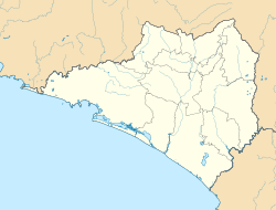
La Yerbabuena, Comala
Appearance
This article has multiple issues. Please help improve it or discuss these issues on the talk page. (Learn how and when to remove these messages)
|
La Yerbabuena | |
|---|---|
| Coordinates: 19°28′33″N 103°41′06″W / 19.47583°N 103.68500°W | |
| State | Colima |
| Municipality | Comala |
| Elevation | 1,477 m (4,846 ft) |
| Population (2010) | |
| • Total | 47 |
| [1] | |
| Time zone | Central (UTC−6) |
La Yerbabuena is a small locality in the municipality of Comala, Colima, Mexico.
Description
[edit]Its population is mainly composed of farmers and ranchers, totaling approximately 31 inhabitants. La Yerbabuena is located at 1,470 meters above sea level. The locality is situated 8 km from the Colima Volcano. It is an ideal camping destination due to its landscapes within the protected area of El Jabalí and its proximity to the Nevado de Colima National Park. In the surrounding areas, there is a small park where white-tailed deer are raised.
References
[edit]- ^ Instituto Nacional de Estadística y Geografía (2010). "Principales resultados por localidad 2010 (ITER)".
{{cite web}}: Unknown parameter|status=ignored (help)
External links
[edit]- "La Yerbabuena". comala.gob.mx. Archived from the original on 10 Jun 2023. Retrieved 18 July 2024.


