List of listed buildings in Lerwick
Appearance
This is a list of listed buildings in the parish of Lerwick, in Shetland, Scotland.
List
[edit]| Name | Location | Date Listed | Grid Ref. [note 1] | Geo-coordinates | Notes | LB Number [note 2] | Image |
|---|---|---|---|---|---|---|---|
| 169-171 (Odd Nos) Commercial Street, Including Gate And Gatepiers | 60°09′16″N 1°08′39″W / 60.154558°N 1.144082°W | Category C(S) | 43587 |  Upload Photo | |||
| 86 Commercial Street | 60°09′14″N 1°08′37″W / 60.153854°N 1.143578°W | Category B | 43598 |  Upload Photo | |||
| 106 Commercial Street, Clydesdale Bank | 60°09′16″N 1°08′37″W / 60.154439°N 1.143707°W | Category C(S) | 43601 | 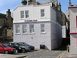
| |||
| Market Cross | 60°09′11″N 1°08′33″W / 60.153174°N 1.142623°W | Category C(S) | 43628 | 
| |||
| Freefield, Hay's Dock And Storehouse | 60°09′30″N 1°09′00″W / 60.158277°N 1.149877°W | Category B | 37261 | 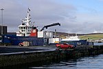
| |||
| 12-14 (Even Nos) Greenfield Place, St Magnus' Episcopal Church And Rectory, Including Boundary Walls | 60°09′07″N 1°08′20″W / 60.151902°N 1.13891°W | Category B | 37270 | 
| |||
| 44-50 (Even Nos) Commercial Street, Lerwick Post Office, With Yard Wall And Gatepiers | 60°09′11″N 1°08′29″W / 60.153176°N 1.141489°W | Category B | 37276 | 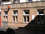
| |||
| 2-4 (Even Nos) Greenfield Place | 60°09′06″N 1°08′27″W / 60.151743°N 1.140715°W | Category B | 37237 |  Upload Photo | |||
| Hillhead And Knab Road, Annsbrae House And 1 And 2 Annsbrae Place, Including Outbuildings, Gates, Gatepiers, Boundary Walls And Railings | 60°09′05″N 1°08′31″W / 60.151338°N 1.141843°W | Category B | 37257 |  Upload Photo | |||
| 12 Charlotte Street, Lystina House, Including Boundary Walls, Gates And Gatepiers | 60°09′16″N 1°08′46″W / 60.154489°N 1.145994°W | Category C(S) | 43579 |  Upload Photo | |||
| 167 Commercial Street | 60°09′16″N 1°08′38″W / 60.15444°N 1.143905°W | Category C(S) | 43586 |  Upload Photo | |||
| 38-42 (Even Nos) Commercial Street | 60°09′11″N 1°08′28″W / 60.153146°N 1.141003°W | Category B | 43591 |  Upload Photo | |||
| 60-62 (Even Nos) Commercial Street, Anderson & Co | 60°09′11″N 1°08′33″W / 60.153182°N 1.142389°W | Category C(S) | 43593 |  Upload Photo | |||
| 66 Commercial Street | 60°09′12″N 1°08′35″W / 60.153266°N 1.142945°W | Category C(S) | 43595 |  Upload Photo | |||
| 90-92 (Even Nos) Commercial Street | 60°09′15″N 1°08′37″W / 60.154087°N 1.143554°W | Category C(S) | 43599 |  Upload Photo | |||
| 116-126 (Even Nos) Commercial Street, Charlotte Place | 60°09′18″N 1°08′37″W / 60.154878°N 1.143678°W | Category B | 43602 |  Upload Photo | |||
| Kantersted Road, Seafield, Including Steading, Boundary Walls, Gatepiers, Railings, And Gates | 60°08′32″N 1°09′45″W / 60.142131°N 1.162483°W | Category B | 43618 |  Upload Photo | |||
| King Harald Street, Islesburgh House, Including Boundary Walls, Gatepiers And Steps | 60°09′13″N 1°08′58″W / 60.153569°N 1.149512°W | Category B | 43620 | 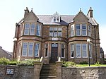
| |||
| 32-36 (Even Nos) King Harald Street, Summerside, Solheim And Carradale, Including Boundary Walls, Railings, Gates, And Gatepiers | 60°09′08″N 1°08′52″W / 60.152166°N 1.147783°W | Category C(S) | 43621 | 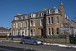
| |||
| Market Street, Garrison Theatre | 60°09′18″N 1°08′46″W / 60.155073°N 1.145978°W | Category C(S) | 43629 |  Upload Photo | |||
| Prince Alfred Street, 1 And 2 Carlton Place, Including Boundary Wall And Gate | 60°09′10″N 1°08′47″W / 60.152803°N 1.146271°W | Category C(S) | 43632 |  Upload Photo | |||
| 4-8 (Even Nos) Queen's Lane And 1 Queen's Place | 60°09′08″N 1°08′30″W / 60.152217°N 1.141748°W | Category C(S) | 43633 |  Upload Photo | |||
| 26 Church Road, Including Boundary Walls | 60°09′06″N 1°08′29″W / 60.151792°N 1.141308°W | Category B | 37260 |  Upload Photo | |||
| Twageos Road, Anderson High School (Formerly Anderson Institute), Including Wings, Boundary Walls, Railing, And Gatepiers | 60°08′59″N 1°08′12″W / 60.149733°N 1.136697°W | Category B | 37264 | 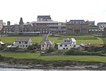
| |||
| 81-87 (Odd Nos) Commercial Street And 2 Queen's Lane, Royal Bank Of Scotland, With Boundary Wall And Gatepiers | 60°09′11″N 1°08′30″W / 60.152943°N 1.141603°W | Category B | 37267 | 
| |||
| Esplanade, Between Grieg's Closs And Campbell's Close, The Peerie Shop | 60°09′15″N 1°08′35″W / 60.154085°N 1.143122°W | Category C(S) | 37268 | 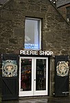
| |||
| Lower Hillhead And Union Street, St Ringan's Church (United Free Church of Scotland), Including Church Hall, Boundary Walls, And Gatepiers | 60°09′11″N 1°08′48″W / 60.153155°N 1.146586°W | Category B | 37269 | 
| |||
| 14 Commercial Street, The Sea Door, Including Murray's Lodberry And Macbeath's Lodberry | 60°09′10″N 1°08′18″W / 60.152769°N 1.138311°W | Category B | 37240 | 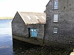
| |||
| 49 Commercial Street, Seafield House, And 1-3 (Odd Nos) Chromate Lane | 60°09′10″N 1°08′25″W / 60.152872°N 1.140236°W | Category B | 37245 |  Upload Photo | |||
| 103 And 105 Commercial Street, Including Heddle's Court | 60°09′11″N 1°08′34″W / 60.152924°N 1.142756°W | Category B | 37253 |  Upload Photo | |||
| Bell's Road And Gilbertson Road, Inches, Including Boundary Walls, Gatepiers And Pump | 60°09′13″N 1°09′18″W / 60.153496°N 1.154863°W | Category C(S) | 43576 |  Upload Photo | |||
| 25 Burgh Road, Including Boundary Walls, Railings And Gate | 60°09′15″N 1°09′03″W / 60.154251°N 1.150863°W | Category C(S) | 43578 | 
| |||
| 107 Commercial Street And 1 Mounthooly Street | 60°09′11″N 1°08′34″W / 60.153023°N 1.142771°W | Category C(S) | 43581 |  Upload Photo | |||
| 143-151 (Odd Nos) Commercial Street, Grand Hotel | 60°09′14″N 1°08′38″W / 60.153928°N 1.143901°W | Category B | 43584 |  Upload Photo | |||
| 175 Commercial Street, Including Steps And Handrail | 60°09′17″N 1°08′39″W / 60.15472°N 1.144114°W | Category C(S) | 43589 |  Upload Photo | |||
| Esplanade And Irvine Place, Harbour Master's Office, Including Yard Wall | 60°09′13″N 1°08′34″W / 60.153598°N 1.142864°W | Category C(S) | 43604 |  Upload Photo | |||
| Grantfield, Former Ice Factory | 60°09′31″N 1°09′13″W / 60.158598°N 1.153742°W | Category B | 43606 |  Upload Photo | |||
| Hayfield Lane And Gilbertson Road, Hayfield House | 60°09′13″N 1°09′25″W / 60.153581°N 1.157059°W | Category B | 43611 | 
| |||
| Hillhead, Wesley (Methodist) Manse, Including Outbuilding, Boundary Walls, Railings And Gatepiers | 60°09′09″N 1°08′46″W / 60.152443°N 1.146191°W | Category B | 43614 |  Upload Photo | |||
| Knab Road, Breiwick Road, And Lover's Loan, Lerwick Old Cemetery, Including Boundary Wall And Entrance Gate | 60°09′01″N 1°08′26″W / 60.150215°N 1.140431°W | Category C(S) | 43623 |  Upload Photo | |||
| 2 Leog Lane, Leog House, Including Boundary Walls And Gatepiers | 60°09′05″N 1°08′16″W / 60.1515°N 1.137768°W | Category C(S) | 43626 |  Upload Photo | |||
| St Olaf Street, St Clement's Hall, Including Steps, Pedestals, Boundary Walls And Gatepiers | 60°09′18″N 1°08′52″W / 60.155058°N 1.147852°W | Category C(S) | 43634 | 
| |||
| Twageos Road And Midgarth Crescent, Bruce Hostel, With Terraces, Boundary Walls, Entrance Arch, Gates, And Gatepiers | 60°09′01″N 1°08′14″W / 60.150275°N 1.137206°W | Category B | 43638 | 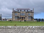
| |||
| 24-30 (Even Nos) Commercial Street, Queen's Hotel, And 2 Church Lane, Lifeboat Station, Including Sea Walls | 60°09′11″N 1°08′24″W / 60.153058°N 1.139961°W | Category B | 37246 | 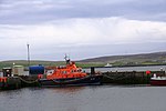
| |||
| 1 And 2 Aitken's Place | 60°09′17″N 1°08′47″W / 60.154815°N 1.146381°W | Category C(S) | 43575 |  Upload Photo | |||
| 109 Commercial Street And 2-4 (Even Nos) Mounthooly Street | 60°09′11″N 1°08′35″W / 60.15306°N 1.142951°W | Category C(S) | 43582 |  Upload Photo | |||
| 84 Commercial Street | 60°09′14″N 1°08′37″W / 60.153791°N 1.143526°W | Category B | 43597 |  Upload Photo | |||
| Grantfield, Skipidock | 60°09′31″N 1°09′18″W / 60.158739°N 1.154873°W | Category B | 43607 | 
| |||
| 11 Greenfield Place, Including Boundary Walls And Gatepiers | 60°09′04″N 1°08′20″W / 60.15114°N 1.138984°W | Category C(S) | 43608 |  Upload Photo | |||
| Gressy Loan, Janet Courtney Hostel, Including Terrace | 60°08′56″N 1°08′10″W / 60.148867°N 1.13609°W | Category B | 43609 |  Upload Photo | |||
| Hillhead And Church Road, St Olaf's Hall (Formerly St Olaf's Church) | 60°09′07″N 1°08′31″W / 60.151903°N 1.141828°W | Category C(S) | 43613 |  Upload Photo | |||
| 14 Law Lane, Windhouse, Including Retaining Wall, Boundary Walls, And Outbuildings | 60°09′09″N 1°08′40″W / 60.152557°N 1.144333°W | Category B | 43625 |  Upload Photo | |||
| Gremista Road, The Bod Of Gremista | 60°10′12″N 1°09′53″W / 60.169955°N 1.164803°W | Category B | 37258 | 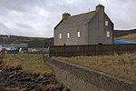
| |||
| Freefield Road, The Store | 60°24′21″N 1°07′03″W / 60.405898°N 1.117489°W | Category B | 37275 |  Upload Photo | |||
| 2-8 (Even Nos) Commercial Street, Including Sea Wall, Copeland's And Stout's Lodberries And Piers | 60°09′09″N 1°08′13″W / 60.152546°N 1.137056°W | Category B | 37238 | 
| |||
| 10 Commercial Street, Including Torrie's Lodberry And Boundary Wall | 60°09′09″N 1°08′15″W / 60.152603°N 1.137577°W | Category B | 37239 |  Upload Photo | |||
| 41-43 (Odd Nos) Commercial Street, Lochend House, Including Courtyard, Doorpiece, Retaining And Boundary Walls | 60°09′10″N 1°08′24″W / 60.152744°N 1.140005°W | Category B | 37243 |  Upload Photo | |||
| 101 Commercial Street, And 1 And 2 Gardie Lane | 60°09′11″N 1°08′33″W / 60.152967°N 1.142539°W | Category B | 37252 |  Upload Photo | |||
| 115-117 (Odd Nos) Commercial Street, Bank Of Scotland, Including Railings And Piers | 60°09′12″N 1°08′36″W / 60.153323°N 1.143358°W | Category B | 37254 |  Upload Photo | |||
| 64 Commercial Street | 60°09′12″N 1°08′34″W / 60.153212°N 1.142857°W | Category C(S) | 43594 |  Upload Photo | |||
| Esplanade, Leask's | 60°09′14″N 1°08′35″W / 60.153995°N 1.143142°W | Category C(S) | 43605 |  Upload Photo | |||
| 4 Hillhead, Including Boundary Walls And Railings | 60°09′08″N 1°08′43″W / 60.152275°N 1.145204°W | Category C(S) | 43617 |  Upload Photo | |||
| St Olaf Street And Harbour Street, Parish Church Of St Margaret (Roman Catholic), Including 87 St Olaf Street, Boundary Walls, Gate And Gatepiers | 60°09′20″N 1°08′56″W / 60.15555°N 1.14901°W | Category C(S) | 43635 | 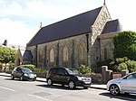
| |||
| 9 Commercial Street, The Old Manse, Including Boundary Walls And Wash-House | 60°09′08″N 1°08′13″W / 60.152321°N 1.136972°W | Category B | 37265 | 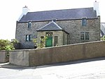
| |||
| 25-29 (Odd Nos) Commercial Street | 60°09′09″N 1°08′19″W / 60.152582°N 1.13855°W | Category C(S) | 37272 |  Upload Photo | |||
| 18 Commercial Street, "Steamer Store" | 60°09′10″N 1°08′19″W / 60.152824°N 1.13849°W | Category B | 37241 |  Upload Photo | |||
| Commercial Road And Harbour Street, Fort Charlotte | 60°09′19″N 1°08′43″W / 60.155365°N 1.145268°W | Category A | 37255 | 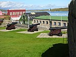
| |||
| 113 Commercial Street | 60°09′11″N 1°08′35″W / 60.153187°N 1.143145°W | Category C(S) | 43583 |  Upload Photo | |||
| 165 Commercial Street | 60°09′16″N 1°08′38″W / 60.154368°N 1.143871°W | Category C(S) | 43585 |  Upload Photo | |||
| 12 Commercial Street And Scarfataing, Including Sea Wall | 60°09′09″N 1°08′16″W / 60.152614°N 1.137883°W | Category C(S) | 43590 |  Upload Photo | |||
| Hillhead And King Erik Street, Lerwick War Memorial | 60°09′16″N 1°08′49″W / 60.154505°N 1.147038°W | Category B | 43612 | 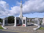
| |||
| 4-8 (Even Nos) Law Lane | 60°09′10″N 1°08′37″W / 60.152821°N 1.143569°W | Category B | 43624 |  Upload Photo | |||
| Lower Hillhead And Prince Alfred Street, 3-6 (Inclusive Nos) Carlton Place | 60°09′10″N 1°08′46″W / 60.152873°N 1.146071°W | Category C(S) | 43627 |  Upload Photo | |||
| North Ness, North Ness House, Including Boundary Walls And Gatepiers | 60°09′29″N 1°08′45″W / 60.157955°N 1.145886°W | Category B | 37262 |  Upload Photo | |||
| King Erik Street And Market Street, Police Station, County Buildings, And Sheriff Courthouse (Formerly Zetland County Buildings), Including Boundary Walls, Gatepiers, And Railings | 60°09′18″N 1°08′50″W / 60.154945°N 1.147099°W | Category B | 37263 | 
| |||
| 69-73 (Odd Nos) Commercial Street | 60°09′11″N 1°08′28″W / 60.152993°N 1.140989°W | Category C(S) | 37273 |  Upload Photo | |||
| 32 Commercial Street, Old Tolbooth | 60°09′12″N 1°08′26″W / 60.153197°N 1.140515°W | Category B | 37247 | 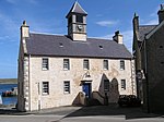
| |||
| 99 Commercial Street | 60°09′10″N 1°08′32″W / 60.152912°N 1.142324°W | Category B | 37251 |  Upload Photo | |||
| Hillhead And Charlotte Street, Lerwick Town Hall, Including Lamp Standards, Gatepiers, Boundary Walls And Railings | 60°09′16″N 1°08′47″W / 60.154465°N 1.146444°W | Category B | 37256 | 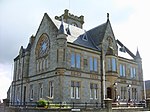
| |||
| Quarff Church (Church Of Scotland), Including Kirkyard Wall And Gatepiers | 60°06′05″N 1°13′53″W / 60.101396°N 1.23128°W | Category B | 12671 | 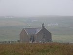
| |||
| Burgh Road, Gilbertson Park Boundary Wall, Gates, And Gatepiers | 60°09′17″N 1°09′14″W / 60.154845°N 1.153856°W | Category B | 43577 |  Upload Photo | |||
| 51-61 (Odd Nos) Commercial Street | 60°09′11″N 1°08′25″W / 60.152979°N 1.140233°W | Category C(S) | 43580 |  Upload Photo | |||
| 173 Commercial Street | 60°09′17″N 1°08′38″W / 60.154629°N 1.144026°W | Category C(S) | 43588 |  Upload Photo | |||
| 52 Commercial Street, With Gatepiers | 60°09′11″N 1°08′31″W / 60.153187°N 1.141848°W | Category C(S) | 43592 |  Upload Photo | |||
| 80-82 (Even Nos) Commercial Street | 60°09′13″N 1°08′36″W / 60.153692°N 1.143456°W | Category B | 43596 |  Upload Photo | |||
| Esplanade, Ellesmere Buildings | 60°09′12″N 1°08′33″W / 60.153408°N 1.142617°W | Category C(S) | 43603 |  Upload Photo | |||
| King Harald Street And Union Street, Islesburgh Community Centre (Formerly Lerwick Central Public School), Including Playshelters, Boundary Walls, Railings, Gates, And Gatepiers | 60°09′10″N 1°08′57″W / 60.152812°N 1.149153°W | Category B | 43619 | 
| |||
| North Ness, Gutters' Hut | 60°09′32″N 1°08′44″W / 60.158994°N 1.14557°W | Category B | 43630 |  Upload Photo | |||
| 78 St Olaf Street, Vogalee, With Boundary Walls, Railings And Gate | 60°09′16″N 1°08′52″W / 60.154411°N 1.147761°W | Category C(S) | 43636 |  Upload Photo | |||
| Sea Road, Westhall, Including Boundary And Terrace Walls | 60°08′26″N 1°09′47″W / 60.140591°N 1.163135°W | Category C(S) | 43637 |  Upload Photo | |||
| Commercial Street, 1 Hayfield Court, Including Garden Walls And Railing | 60°09′09″N 1°08′16″W / 60.152515°N 1.137831°W | Category C(S) | 37271 |  Upload Photo | |||
| Commercial Street, Telephone Kiosk | 60°09′16″N 1°08′34″W / 60.15446°N 1.142914°W | Category B | 37277 |  Upload Photo | |||
| 93-95 (Odd Nos) Commercial Street | 60°09′11″N 1°08′31″W / 60.152973°N 1.141998°W | Category C(S) | 37249 |  Upload Photo | |||
| 97 Commercial Street | 60°09′11″N 1°08′32″W / 60.152956°N 1.142143°W | Category B | 37250 |  Upload Photo | |||
| Gulberwick Church (Church Of Scotland), Including Kirkyard Wall, Gate And Gatepiers | 60°07′57″N 1°12′20″W / 60.132384°N 1.2055°W | Category C(S) | 44555 |  Upload Photo | |||
| 96 Commercial Street, Medical Hall | 60°09′15″N 1°08′37″W / 60.154151°N 1.143679°W | Category C(S) | 43600 |  Upload Photo | |||
| 1-7 (Odd Nos) Harbour Street, And 1-3 (Odd Nos) Commercial Road, Brentham Place | 60°09′23″N 1°08′42″W / 60.156315°N 1.145064°W | Category B | 43610 |  Upload Photo | |||
| 12 Hillhead, Including Boundary Walls, Railings And Gatepiers | 60°09′09″N 1°08′44″W / 60.152546°N 1.145468°W | Category B | 43615 |  Upload Photo | |||
| 2 Hillhead, Gordon Cottage, Including Boundary Walls And Railings | 60°09′07″N 1°08′43″W / 60.152015°N 1.145211°W | Category B | 43616 |  Upload Photo | |||
| North Ness, Jahara, Including Boundary Walls And Gatepiers | 60°09′28″N 1°08′45″W / 60.157811°N 1.145961°W | Category C(S) | 43631 |  Upload Photo | |||
| 31 Commercial Street, Quendale House, Including Retaining, Steps, Boundary Wall, Railing, Gatepiers And Gate | 60°09′09″N 1°08′20″W / 60.152495°N 1.138931°W | Category B | 37266 | 
| |||
| Esplanade, Albert Building | 60°09′19″N 1°08′35″W / 60.155414°N 1.143177°W | Category B | 37274 | 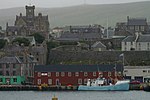
| |||
| 1-12 (Even Nos) Twageos Road, Anderson Homes | 60°09′06″N 1°08′07″W / 60.151709°N 1.135403°W | Category C(S) | 37278 |  Upload Photo | |||
| 1 Greenfield Place, St Columba's Church (Church Of Scotland), Including Gates, Retaining And Boundary Walls | 60°09′06″N 1°08′29″W / 60.151558°N 1.141261°W | Category B | 37236 | 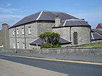
| |||
| 20 Commercial Street, The Lodberrie, Including Bains Beach Sea Wall And Steps, Craigie Stane Noost And Sea Wall | 60°09′10″N 1°08′21″W / 60.152883°N 1.139173°W | Category A | 37242 |  Upload Photo | |||
| 45 Commercial Street, Sea Winds | 60°09′10″N 1°08′24″W / 60.152826°N 1.140093°W | Category B | 37244 |  Upload Photo | |||
| 67 Commercial Street And 1 Church Lane (Formerly South Kirk Closs) | 60°09′11″N 1°08′27″W / 60.152966°N 1.140882°W | Category B | 37248 |  Upload Photo |
Key
[edit]The scheme for classifying buildings in Scotland is:
- Category A: "buildings of national or international importance, either architectural or historic; or fine, little-altered examples of some particular period, style or building type."[1]
- Category B: "buildings of regional or more than local importance; or major examples of some particular period, style or building type, which may have been altered."[1]
- Category C: "buildings of local importance; lesser examples of any period, style, or building type, as originally constructed or moderately altered; and simple traditional buildings which group well with other listed buildings."[1]
In March 2016 there were 47,288 listed buildings in Scotland. Of these, 8% were Category A, and 50% were Category B, with the remaining 42% being Category C.[2]
Notes
[edit]- ^ Sometimes known as OSGB36, the grid reference (where provided) is based on the British national grid reference system used by the Ordnance Survey.
• "Guide to National Grid". Ordnance Survey. Retrieved 12 December 2007.
• "Get-a-map". Ordnance Survey. Retrieved 17 December 2007. - ^ Historic Environment Scotland assign a unique alphanumeric identifier to each designated site in Scotland, for listed buildings this always begins with "LB", for example "LB12345".
References
[edit]- All entries, addresses and coordinates are based on data from Historic Scotland. This data falls under the Open Government Licence
- ^ a b c "What is Listing?". Historic Environment Scotland. Retrieved 29 May 2018.
- ^ Scotland's Historic Environment Audit 2016 (PDF). Historic Environment Scotland and the Built Environment Forum Scotland. pp. 15–16. Retrieved 29 May 2018.
