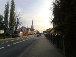
Płoty
Appearance
Płoty | |
|---|---|
 Płoty | |
| Coordinates: 53°48′29″N 15°15′53″E / 53.80806°N 15.26472°E | |
| Country | |
| Voivodeship | West Pomeranian |
| County | Gryfice |
| Gmina | Płoty |
| Established | 8th century |
| Town rights | 1277 |
| Government | |
| • Mayor | Marian Maliński |
| Area | |
• Total | 4.12 km2 (1.59 sq mi) |
| Population (2010)[1] | |
• Total | 4,035 |
| • Density | 980/km2 (2,500/sq mi) |
| Time zone | UTC+1 (CET) |
| • Summer (DST) | UTC+2 (CEST) |
| Postal code | 72-310 |
| Car plates | ZGY |
| Website | http://www.ploty.pl/ |
 | |
Płoty [ˈpwɔtɨ] (Kashubian: Płota; German: Plathe an der Rega) is a town in Gryfice County, West Pomeranian Voivodeship, Poland, with 4,035 inhabitants (2010).
Demographics
[edit]| Year | Pop. | ±% |
|---|---|---|
| 1871 | 2,091 | — |
| 1880 | 2,226 | +6.5% |
| 1890 | 2,262 | +1.6% |
| 1900 | 2,276 | +0.6% |
| 1910 | 2,849 | +25.2% |
| 1925 | 3,272 | +14.8% |
| 1939 | 3,646 | +11.4% |
| 1950 | 1,817 | −50.2% |
| 1960 | 3,088 | +70.0% |
| 2010 | 4,035 | +30.7% |
| Source: [2][1] | ||
Notable people
[edit]- Fritz Köpke (1902–1991), German athlete, competed in the men's high jump at the 1928 Summer Olympics
International relations
[edit]Płoty is twinned with:
References
[edit]- ^ a b Stan i struktura ludności oraz ruch naturalny w przekroju terytorialnym w 2010 r. (PDF) (in Polish). Warszawa: Główny Urząd Statystyczny. 2011. p. 108. Archived from the original (PDF) on 13 November 2011.
- ^ Dokumentacja Geograficzna (in Polish). Vol. 3/4. Warszawa: Instytut Geografii Polskiej Akademii Nauk. 1967. p. 38.
External links
[edit]Wikimedia Commons has media related to Płoty.


