Pusztaottlaka
Pusztaottlaka
Otlaca-Pustă | |
|---|---|
 | |
| Country | |
| County | Békés |
| Area | |
• Total | 18.88 km2 (7.29 sq mi) |
| Population (2015) | |
• Total | 474[1] |
| • Density | 25.1/km2 (65/sq mi) |
| Time zone | UTC+1 (CET) |
| • Summer (DST) | UTC+2 (CEST) |
| Postal code | 5665 |
| Area code | 68 |

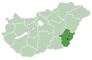
Pusztaottlaka (Puszta-Ott·lak·a; Romanian: Otlaca-Pustă) is a village in Békés County, in the Southern Great Plain region of south-east Hungary.
Geography
[edit]It covers an area of 18.88 km² and has a population of 471 people (2002).
Population
[edit]According to the last census in 2015 Pusztaottlaka/Otlaca-Pusta had a population of 474 people.[1] The majority of the population is Hungarian with a 17% Romanian minority (74 people who spoke Romanian as a mother language).
Religion
[edit]According to the last census in 2001 133 people belonged to the Roman Catholic Church, 40 were Lutherans and 140 people followed "another faith". In the case of Pusztaottlaka/Otlaca-Pusta the latters are mainly Orthodox Romanians.
Name
[edit]Pusztaottlaka means "dwelling place on the puszta" in Hungarian. The Romanian name is the transliteration of the Hungarian one.
References
[edit]- ^ a b Gazetteer of Hungary, 1st January 2015. Hungarian Central Statistical Office. 3 September 2015
46°33′N 20°59′E / 46.550°N 20.983°E


