Santo Tomás, Baja California
Appearance
This article includes a list of references, related reading, or external links, but its sources remain unclear because it lacks inline citations. (April 2022) |
Santo Tomás, Baja California | |
|---|---|
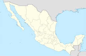
| Coordinates: 30°50′16″N 116°03′26″W / 30.83778°N 116.05722°W | |
| Country | Mexico |
| State | Baja California |
| Municipality | Ensenada |
| Time zone | UTC-8 (Northwest US Pacific) |
| • Summer (DST) | UTC-7 (Northwest) |
Santo Tomás a town in Ensenada Municipality, Baja California, on the Pacific Coast of Mexico. Santo Tomás is a primarily a wine-growing region, though it is increasingly a tourist destination.
History
[edit]
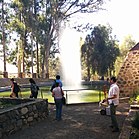
It was originally the site of the Misión Santo Tomás de Aquino. After the mission was abandoned, it was taken as a post for the Mexican frontier garrison and for a time as the capital of the territory of Baja California. The town grew up east of the Mission site.
Economy
[edit]Santo Tomás is a wine-growing region, home to numerous vineyards and wineries. Since the rise in popularity of Valle de Guadalupe as a premier wine region in Baja California, Santo Tomás has begun to develop tourist accommodations, such as hotels and fine dining.
See also
[edit]References
[edit]- Meigs, Peveril, III. 1935. The Dominican Mission Frontier of Lower California. University of California Publications in Geography No. 7. Berkeley.
- Vernon, Edward W. 2002. Las Misiones Antiguas: The Spanish Missions of Baja California, 1683-1855. Viejo Press, Santa Barbara, California.


