
Santo Tomas, La Union
Santo Tomas | |
|---|---|
| Municipality of Santo Tomas | |
 Welcome arch | |
 Flag  Seal | |
 Map of La Union with Santo Tomas highlighted | |
OpenStreetMap  | |
.svg) Santo Tomas Location within the Philippines | |
| Coordinates: 16°17′N 120°23′E / 16.28°N 120.38°E | |
| Country | Philippines |
| Region | Ilocos Region |
| Province | La Union |
| District | 2nd district |
| Founded | 1764 |
| Barangays | 24 (see Barangays) |
| Government | |
| • Type | Sangguniang Bayan |
| • mayor of Santo Tomas[*] | Severino C. Carbonell |
| • Vice Mayor | Winnie N. Doctolero |
| • Representative | Sandra Y. Eriguel |
| • Municipal Council | Members |
| • Electorate | 25,929 voters (2022) |
| Area | |
• Total | 64.00 km2 (24.71 sq mi) |
| Elevation | 42 m (138 ft) |
| Highest elevation | 308 m (1,010 ft) |
| Lowest elevation | −2 m (−7 ft) |
| Population (2020 census)[4] | |
• Total | 40,846 |
| • Density | 640/km2 (1,700/sq mi) |
| • Households | 10,392 |
| Demonym | Tomasian |
| Economy | |
| • Income class | 4th municipal income class |
| • Poverty incidence | 10.54 |
| • Revenue | ₱ 144.1 million (2020) |
| • Assets | ₱ 787.7 million (2020) |
| • Expenditure | ₱ 129.1 million (2020) |
| • Liabilities | ₱ 82.55 million (2020) |
| Service provider | |
| • Electricity | La Union Electric Cooperative (LUELCO) |
| Time zone | UTC+8 (PST) |
| ZIP code | 2505 |
| PSGC | |
| IDD : area code | +63 (0)72 |
| Native languages | Ilocano Pangasinan Tagalog |
| Website | www |
Santo Tomas, officially the Municipality of Santo Tomas (Ilocano: Ili ti Santo Tomas; Pangasinan: Baley na Santo Tomas; Filipino: Bayan ng Santo Tomas), is a 4th class municipality in the province of La Union, Philippines. According to the 2020 census, it has a population of 40,846 people.[4]
Santo Tomas is 230 kilometres (140 mi) from Metro Manila and 39 kilometres (24 mi) from San Fernando, the provincial capital.
History
[edit]The 18th and 19th centuries marked the active expansion of Ilocano territory. Scores of settlers from the Ilocos provinces pushed their way south so that by the end of the 19th century, Aringay was home to mostly Ilocanos, Ilocanized Pangasinenses, and Pangasinenses still speaking their native language. On December 22, 1941, units of the 192nd and 194th Tank Battalion of the United States Army Forces in the Far East engaged the Imperial Japanese Army's 4th Tank Regiment in Damortis, and lost with the capture of the Commanding Officer Lt. Ben R. Morin. This was the first time that the United States Army had a tank-to-tank battle. The armored battalions of the USAFFE fought continuously until during the Invasion of the Philippines, until April 7, 1942, two days before the Fall of Bataan.[6]
Geography
[edit]Barangays
[edit]Santo Tomas is politically subdivided into 24 barangays. [7] Each barangay consists of puroks and some have sitios.
- Ambitacay
- Bail
- Balaoc
- Balsaan
- Baybay
- Cabaruan
- Casantaan
- Casilagan
- Cupang
- Damortis
- Fernando
- Linong
- Lomboy
- Malabago
- Namboongan
- Namonitan
- Narvacan
- Patac
- Poblacion
- Pongpong
- Raois
- Tubod
- Tococ
- Ubagan
Climate
[edit]| Climate data for Santo Tomas, La Union | |||||||||||||
|---|---|---|---|---|---|---|---|---|---|---|---|---|---|
| Month | Jan | Feb | Mar | Apr | May | Jun | Jul | Aug | Sep | Oct | Nov | Dec | Year |
| Mean daily maximum °C (°F) | 30 (86) |
32 (90) |
33 (91) |
34 (93) |
33 (91) |
31 (88) |
30 (86) |
30 (86) |
30 (86) |
31 (88) |
31 (88) |
31 (88) |
31 (88) |
| Mean daily minimum °C (°F) | 20 (68) |
21 (70) |
22 (72) |
24 (75) |
25 (77) |
25 (77) |
25 (77) |
25 (77) |
24 (75) |
23 (73) |
22 (72) |
21 (70) |
23 (74) |
| Average precipitation mm (inches) | 15 (0.6) |
16 (0.6) |
24 (0.9) |
33 (1.3) |
102 (4.0) |
121 (4.8) |
177 (7.0) |
165 (6.5) |
144 (5.7) |
170 (6.7) |
56 (2.2) |
23 (0.9) |
1,046 (41.2) |
| Average rainy days | 6.3 | 6.6 | 9.5 | 12.8 | 20.6 | 23.5 | 25.4 | 23.4 | 23.2 | 21.4 | 14.0 | 8.2 | 194.9 |
| Source: Meteoblue[8] | |||||||||||||
Demographics
[edit]| Year | Pop. | ±% p.a. |
|---|---|---|
| 1903 | 5,446 | — |
| 1918 | 8,046 | +2.64% |
| 1939 | 10,352 | +1.21% |
| 1948 | 12,897 | +2.47% |
| 1960 | 14,929 | +1.23% |
| 1970 | 19,482 | +2.69% |
| 1975 | 21,341 | +1.84% |
| 1980 | 22,610 | +1.16% |
| 1990 | 27,352 | +1.92% |
| 1995 | 28,192 | +0.57% |
| 2000 | 31,204 | +2.20% |
| 2007 | 33,604 | +1.03% |
| 2010 | 35,999 | +2.54% |
| 2015 | 39,092 | +1.58% |
| 2020 | 40,846 | +0.87% |
| Source: Philippine Statistics Authority[9][10][11][12] | ||
In the 2020 census, the population of Santo Tomas, La Union, was 40,846 people,[4] with a density of 640 inhabitants per square kilometre or 1,700 inhabitants per square mile.
Economy
[edit]Poverty incidence of Santo Tomas
10
20
30
40
2006
33.40 2009
22.71 2012
12.28 2015
7.52 2018
3.37 2021
10.54 Source: Philippine Statistics Authority[13][14][15][16][17][18][19][20] |
Government
[edit]Local government
[edit]Santo Tomas, belonging to the second congressional district of the province of La Union, is governed by a mayor designated as its local chief executive and by a municipal council as its legislative body in accordance with the Local Government Code. The mayor, vice mayor, and the councilors are elected directly by the people through an election which is being held every three years.
The Pamahalaang Bayan (Municipal Town Hall) is located on top of a hill.[21][dead link]
Elected officials
[edit]| Position | Name |
|---|---|
| Congressman | Sandra Y. Eriguel |
| Mayor | Severino C. Carbonell |
| Vice-Mayor | Winnie N. Doctolero |
| Councilors | Carlito M. Dela Cruz Jr. |
| Anthony M. Villanueva | |
| Aldreyn S. Cabico | |
| Celiaflor M. Bejar | |
| Noel G. Basi | |
| Leonor J. Tagubat | |
| Lorenzo R. Medina Jr. | |
| Vilea R. Capinpin |
Tourism
[edit]Santo Tomas' coastal areas are suitable for fishing. Local cuisine includes Damortis dried fish (daing stalls along the national highway)[clarify], puto, Bibingka, Nilatekan, and Patopat.[citation needed]
The town holds the Daing Festival every April 20 and an annual town Fiesta every April 24 and 25.
Santo Thomas contains part of the Agoo–Damortis Protected Landscape and Seascape. In 2002, a plan to create a 10 hectare BFAR Mariculture Park within the town was launched.[23][needs update]
Santo Thomas is a DENR-designated Regional Center for Inland Fisheries Research and contains an Institute of Fisheries.[24] The town's "Nutri-Enriched Seaweed Noodles" earned first place in the Aquatic Technology Competition and Marketplace, Phil. Council Aquaculture and Marine Research and Development on January 28, 2010.[citation needed]
The barangay of Damortis is known as the 'Tabo-an of the North’ because of its priceless 'danggit' (often associated with the small malaga), the dalag-baybay, espada, sapsap, pusit, turay, dilis, and shrimp, a local fish, 1 foot basasong, dried bangus (milkfish), patis (fish sauce), alamang, and bagoong.[25][clarification needed]
Shrine of Nuestra Señora del Mar Cautiva Parish Church
[edit]
Religion plays an important role in the town's culture. The patron saint of the town fishermen is Senora Virgen del Mar Cautiva (Virgin of the Sea), whose Feast Day is celebrated every 26 April) at Poblacion.[citation needed]
One of Santo Tomas' cultural icons is the 1785 Holy Guardian Angels Parish Church, which celebrates the Patronal Fiesta on October 2.[26] Its Parish Priests are Father Raul S. Panay and Fr. Emmanuel Bahiwag[27] under the Vicariate of St. Francis Xavier under Vicar Forane, Fr. Joel Angelo Licos,[21][26] under the jurisdiction of the Roman Catholic Diocese of San Fernando de La Union (Latin: Dioecesis Ferdinandopolitanus ab Unione, Suffragan of Lingayen – Dagupan), a diocese of the Latin Church of the Roman Catholic Church in the Philippines. The diocese was established in 1970 from the Archdiocese of Nueva Segovia.[28][29]
In 1845, Padre Santiago Romero, Kura Paroko's[clarification needed] carved three religious statues for the Church out of devotion to the "Virgin of the Rosaries". The statues depicted the Blessed Mother, St. Michael the Archangel, and the Holy Guardian Angels (patron of the Church). "Matutina" through the China Sea is held yearly on July,[clarification needed] where the three images are inserted in three boxes and delivered to Santo Tomas by sailboat. In Bolinao, Pangasinan, Jolo pirates seized the "Matutina" and threw the three boxes of the statues into the sea, after severing the left forearm of the Virgin Mary. Although two of the boxes sank, the Virgin's allegedly remained dry and floated to the parish priest of Santo Tomas. The surviving statue was enthroned at the Church on July 19, 1845, amid reports of miracles, conversions, and healing.[30][better source needed] Augustinian friar Padre Lorenzo Rodriguez created a replacement arm for the statue out of gold and then a second out of ivory. Today, the ivory arm is displayed on the statue, fastened to it with string.[27][better source needed]
Gallery
[edit]-
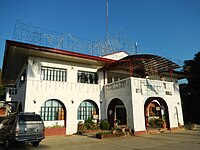 Town hall
 -
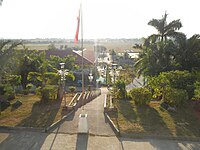 View of downtown from Town Hall hill top
 -
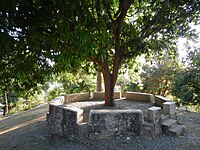 The Town Plaza
 -
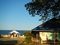 St. Mary of the Sea Academy


References
[edit]- ^ Municipality of Santo Tomas | (DILG)
- ^ "2015 Census of Population, Report No. 3 – Population, Land Area, and Population Density" (PDF). Philippine Statistics Authority. Quezon City, Philippines. August 2016. ISSN 0117-1453. Archived (PDF) from the original on May 25, 2021. Retrieved July 16, 2021.
- ^ https://elevation.maplogs.com/poi/santo_tomas_la_union_philippines.248617.html.
{{cite web}}: Missing or empty|title=(help) - ^ a b c Census of Population (2020). "Region I (Ilocos Region)". Total Population by Province, City, Municipality and Barangay. Philippine Statistics Authority. Retrieved 8 July 2021.
- ^ "PSA Releases the 2021 City and Municipal Level Poverty Estimates". Philippine Statistics Authority. 2 April 2024. Retrieved 28 April 2024.
- ^ "December 22 – The First US Tank in Combat During WWII - Museum of The American G.I." americangimuseum.org. Museum of the American GI. 22 December 1941. Retrieved 26 April 2023.
- ^ "Province: La Union". PSGC Interactive. Quezon City, Philippines: Philippine Statistics Authority. Retrieved 12 November 2016.
- ^ "Santo Tomas: Average Temperatures and Rainfall". Meteoblue. Retrieved 26 April 2020.
- ^ Census of Population (2015). "Region I (Ilocos Region)". Total Population by Province, City, Municipality and Barangay. Philippine Statistics Authority. Retrieved 20 June 2016.
- ^ Census of Population and Housing (2010). "Region I (Ilocos Region)" (PDF). Total Population by Province, City, Municipality and Barangay. National Statistics Office. Retrieved 29 June 2016.
- ^ Censuses of Population (1903–2007). "Region I (Ilocos Region)". Table 1. Population Enumerated in Various Censuses by Province/Highly Urbanized City: 1903 to 2007. National Statistics Office.
- ^ "Province of La Union". Municipality Population Data. Local Water Utilities Administration Research Division. Retrieved 17 December 2016.
- ^ "Poverty incidence (PI):". Philippine Statistics Authority. Retrieved December 28, 2020.
- ^ "Estimation of Local Poverty in the Philippines" (PDF). Philippine Statistics Authority. 29 November 2005.
- ^ "2003 City and Municipal Level Poverty Estimates" (PDF). Philippine Statistics Authority. 23 March 2009.
- ^ "City and Municipal Level Poverty Estimates; 2006 and 2009" (PDF). Philippine Statistics Authority. 3 August 2012.
- ^ "2012 Municipal and City Level Poverty Estimates" (PDF). Philippine Statistics Authority. 31 May 2016.
- ^ "Municipal and City Level Small Area Poverty Estimates; 2009, 2012 and 2015". Philippine Statistics Authority. 10 July 2019.
- ^ "PSA Releases the 2018 Municipal and City Level Poverty Estimates". Philippine Statistics Authority. 15 December 2021. Retrieved 22 January 2022.
- ^ "PSA Releases the 2021 City and Municipal Level Poverty Estimates". Philippine Statistics Authority. 2 April 2024. Retrieved 28 April 2024.
- ^ a b "Local Government Units: Municipality of Santo Thomas". Province of La Union :: Official Website. Archived from the original on 19 July 2013.
- ^ "2019 National and Local Elections" (PDF). Commission on Elections. Retrieved March 6, 2022.
- ^ "Sto. Tomas Mariculture Park". BFAR Mariculture Portal. Archived from the original on 24 February 2013.
- ^ "Don Mariano Marcos Memorial State University - South la Union Campus - Fisheries". Archived from the original on 2012-01-10. Retrieved 2012-12-17.
- ^ La Union town is the 'Tabo-an of the North’ because of its 'danggit' - Yahoo! News Philippines
- ^ a b "Nfo.ph - nfo Resources and Information".
- ^ a b "Luzon Shrines: Nuestra Senora del Mar de Cautiva". Archived from the original on 1 August 2013.
- ^ Catholic-Hierarchy
- ^ Diocese of San Fernando de La Union
- ^ "The mystery behind the ivory forearm of the Blessed Virgin Mary image in Sto. Tomas Church La Union". Tarabitab. Archived from the original on 1 May 2012.
External links
[edit]- La Union Website
- Philippine Standard Geographic Code
- Philippine Census Information
- Local Governance Performance Management System
Places adjacent to Santo Tomas, La Union | ||||||||||||||||
|---|---|---|---|---|---|---|---|---|---|---|---|---|---|---|---|---|
| ||||||||||||||||