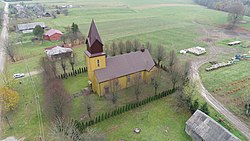
Stemplės
Appearance
Stemplės | |
|---|---|
Stemplės | |
 view of Stemplės | |
| Coordinates: 55°30′10.8″N 21°48′14.4″E / 55.503000°N 21.804000°E | |
| Country | |
| Ethnographic region | Lithuania Minor |
| County | |
| Municipality | Šilutė district municipality |
| Eldership | Švėkšna eldership |
| Population (2021) | |
• Total | 44 |
| Time zone | UTC+2 (EET) |
| • Summer (DST) | UTC+3 (EEST) |
| Climate | Dfb |
Stemplės is a village in the south of the Klaipėda County in western Lithuania. The village was part of the Klaipėda Region and ethnographic Lithuania Minor.
History
[edit]In 2007 the nearby Šilalė oil field started the production.[1][2][3]
Demography
[edit]Historical population
[edit]
|
| |||||||||||||||||||||||||||||||||
| Source: 1902, 1923, 1959 & 1970, 1979, 1989, 2001, 2011 | ||||||||||||||||||||||||||||||||||


