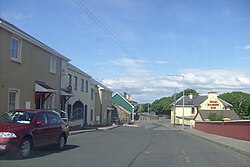
Tullaghan
This article needs additional citations for verification. (March 2017) |
Tullaghan
An Tulachán (Irish) | |
|---|---|
Village | |
 Tullaghan village | |
| Coordinates: 54°28′06″N 8°19′52″W / 54.4683°N 8.3311°W | |
| Country | Ireland |
| Province | Connacht |
| County | County Leitrim |
| Area | |
• Total | 0.53 km2 (0.20 sq mi) |
| Population | 253 |
| Time zone | UTC+0 (WET) |
| • Summer (DST) | UTC-1 (IST (WEST)) |
| Irish Grid Reference | G785578 |
Tullaghan (Irish: An Tulachán[3]) is the most northerly village in County Leitrim, Ireland. Lying at the northern end of Glenade, Tullaghan is in the parish of Kinlough and Glenade and is part of the Manorhamilton electoral area.[4]
Geography
[edit]
Tullaghan is located on the N15 road between Sligo (35 km (22 mi)) and Bundoran, County Donegal (3 km (1.9 mi)). Tullaghan includes a small section of County Sligo and extends east to the edge of Lough Melvin and the Garrison lowlands, west to Bunduff strand (in the north Sligo coastal area) and south to the northern slopes of the Dartry Mountains and the Arroo and Mountain Outliers. The River Drowes denotes the border between County Leitrim and County Donegal and the River Duff forms the border between County Leitrim and County Sligo. The R280 road connects Tullaghan with the rest of County Leitrim. Tullaghan has the single shortest bit of county coastline in Ireland – a mere 4.7 kilometres (2.9 mi) long.[5][6]
History
[edit]
Tullaghan has a high cross located on the roadside of the N15, being erected in its current location in 1778.[7] St Patricks Well is located approximately 3 km west from the village on the coast road past St Patricks church.[8] Back in 1925, Tullaghan village comprised 19 houses, 5 being licensed to sell alcohol.[9]
Religion
[edit]Saint Patrick's Catholic Church was built in 1842.[citation needed]
See also
[edit]References
[edit]- ^ "Tullaghan Map, Leitrim". Archived from the original on 24 June 2021. Retrieved 18 June 2021.
- ^ "Census 2016 Sapmap Area: Settlements Tullaghan". Central Statistics Office (Ireland). April 2016. Archived from the original on 8 March 2018. Retrieved 7 March 2018.
- ^ "An Tulachán/Tullaghan". Placenames Database of Ireland. Government of Ireland - Department of Arts, Heritage and the Gaeltacht and Dublin City University. Archived from the original on 8 March 2018. Retrieved 7 March 2018.
- ^ "Tullaghan". www.townlands.ie. Archived from the original on 19 March 2017. Retrieved 22 March 2017.
- ^ "Counties of Ireland - Leitrim | Ireland". Archived from the original on 8 September 2015. Retrieved 19 March 2017.
- ^ "Places to go". Archived from the original on 18 March 2017. Retrieved 17 March 2017.
- ^ "Tullaghan Cross". Archived from the original on 19 March 2017. Retrieved 19 March 2017.
- ^ "Tullaghan Hill Holy Well | Voices from the Dawn". www.voicesfromthedawn.com. 16 October 2010. Archived from the original on 19 March 2017. Retrieved 22 March 2017.
- ^ Irish Free State (1925). Intoxicating Liquor Commission Report (Report). Vol. Reports of Committees. The Stationery Office. p. 31. Archived from the original on 15 December 2018. Retrieved 21 May 2017.


